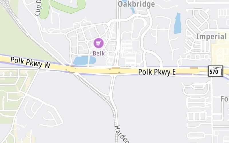
Map & services within two (2) miles
Interactive map shows available cameras, plus nearby fuel, food and lodging


See below for more about this area
Interactive map shows available cameras, plus nearby fuel, food and lodging
See below for more about this area
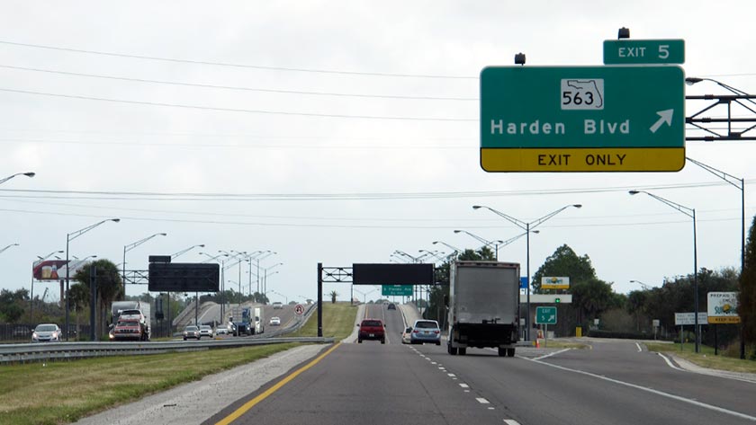
This is Exit 5 of the Polk Parkway.
This junction is located in Lakeland. NOTE: SR 563.
This location is in the Tampa Bay - West Central Florida area.
This location's approximate GPS Coordinates are 27.99626 x -81.97557.
Which directions can I travel from here?
From this junction, traffic can enter traveling both westbound and eastbound. Traffic can also exit traveling both westbound and eastbound.
On to South Florida Avenue, about 1.1 miles away ►
◄ Back to Waring Road, about 1.4 miles away.
Which direction are tolls charged here?
The interactive map and lists on this page include key traveler services within two miles of this destination point.
You will find common services, including gas stations, truck stops, EV charging facilities, fast-food or family restaurants, and hotels. These are displayed on the interactive map as markers, which you can select for more information.
Current driving conditions and weather, along with a more complete list of key services, may be found below the map.

Partly Sunny
91°F / 32.8°C
Feels Like:
93°F / 34.1°C
Visibility
10 Mi / 16.1 Km
3-Hour Precip:
0 In / 0.0 Cm
West Southwest
Winds (WSW)
5.8 MPH / 9.3 KPH
Gusts:
5.8 MPH / 9.3 KPH
▸ Get the full forecast for This Location | The Tampa Bay - West Central Florida area
Conditions and forecasts provided in partnership with AccuWeather.

Weather provided in partnership with AccuWeather.
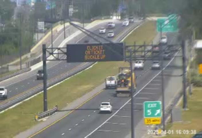
FL-570 @ MM-4.6
Camera Direction: EAST. Source: FDOT - Tampa 33811
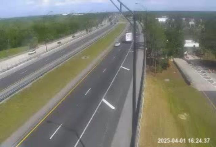
Cameras Closest To Harden Boulevard
1.01 Mi

1.16 Mi
1.56 Mi
2.59 Mi
About this photo:
Eastbound on the Polk Parkway at Exit 5, to Harden Boulevard. Photo taken December 12, 2019.
Photo taken 12-12-2019
More Pictures Near Harden Boulevard


The map above shows all services within about a two (2) mile radius.

Destination Travel

Closest Gas Stations
CITGO
1950 Drane Field Road • 0.73 miles
Store/Fuel Brand: Citgo
SPEEDWAY
3117 South Florida Avenue • 1.35 miles
Store/Fuel Brand: Speedway
SHELL
4607 South Florida Avenue • 1.48 miles
Store/Fuel Brand: Shell
FLORIDA AVENUE MOBIL
2908 South Florida Avenue • 1.54 miles
Store/Fuel Brand: Mobil
Closest EV Chargers
CHARGEPOINT
1401 Town Center Drive • 0.42 miles
CONNECTOR: IEC62196Type1
POWER: 6 KW @ 240 V
CURRENT: 27 Amp AC1
KELLY RECREATION COMPLEX
404 Imperial Boulevard • 0.97 miles
CONNECTOR: IEC62196Type1
POWER: 9 KW @ 240 V
CURRENT: 40 Amp AC1
CHARGEPOINT
4520 South Florida Avenue • 1.50 miles
CONNECTOR: IEC62196Type1
POWER: 6 KW @ 240 V
CURRENT: 27 Amp AC1

Closest Fast Food
Fast food refers ONLY to quick-service and take-out diners. All restaurant types are shown on the map above.
PLANET SMOOTHIE
1606 Town Center Drive • 0.43 miles
MOE'S SOUTHWEST GRILL
1326 Town Center Drive • 0.44 miles
LOUIS PAPPAS CAFE
1318 Town Center Drive • 0.45 miles
BURGER 21
1601 Town Center Drive • 0.47 miles
FIREHOUSE SUBS
3615 South Florida Avenue • 0.98 miles
BURGER KING
3590 Harden Boulevard • 1,183 feet
CHINA WOK
3686 Harden Boulevard • 1,310 feet
JERSEY MIKE'S SUBS
3540 Harden Boulevard • 1,491 feet
Journey to key destinations around and adjacent to Florida!
Communities in this metro area include Destin, Pensacola Beach, Pensacola, Niceville, and Gulf Breeze.
Individual toll maps for this region are listed below.

Communities in this metro area include Jacksonville and Middleburg.
Individual toll maps for this region are listed below.

Communities in this metro area include Apopka, Cocoa, Kissimmee, Lake Buena Vista, Orlando, Saint Cloud, Sanford, Titusville, Melbourne, Poinciana, and Mount Dora.
Individual toll maps for this region are listed below.
Communities in this metro area include Bradenton, Brandon, Saint Petersburg, Spring Hill, and Tampa.
Individual toll maps for this region are listed below.
Communities in this metro area include Fort Pierce, Port Saint Lucie, Stuart, and Vero Beach.
Individual toll maps for this region are listed below.

Communities in this metro area include Fort Lauderdale, Pompano Beach, Hialeah, Opa Locka, Homestead, Kendall, Key Largo, Miramar, Miami, Hollywood, Sunrise, Boca Raton, Delray Beach, West Palm Beach, Jupiter, Davie, Coral Springs, Lake Worth, and Boynton Beach.
Individual toll maps for this region are listed below.
Communities in this metro area include Fort Myers, Naples, and Cape Coral.
Individual toll maps for this region are listed below.
Communities in this metro area include Mobile, Daphne, Dauphin Island, Chickasaw, and Spanish Fort.
Individual toll maps for this region are listed below.

Roads Within Region
 Garcon Point Bridge ▹
 Bob Sikes Bridge ▹
 SR 293 ▹
 First Coast Expressway ▹
 Central Florida Greeneway/Seminole Expy ▹
 Florida's Turnpike ▹
 East West Expressway ▹
 Beachline Expressway ▹
 Western Beltway/Wekiva Pkwy ▹
 Apopka Expressway ▹
 Poinciana Parkway ▹
 SR 453 ▹
 Goldenrod Road Extension ▹
 Osceola Parkway ▹
 SR 451 ▹
 Polk Parkway ▹
 Selmon Expressway ▹
 Suncoast Parkway/Veterans Expy ▹
 Sunshine Skyway ▹
 Pinellas Bayway ▹
 Gateway Expressway ▹
 Airport Expressway ▹
 Alligator Alley ▹
 Dolphin Expressway ▹
 Don Shula Expressway ▹
 Gratigny Parkway ▹
 Sawgrass Expressway ▹
 Snapper Creek Expressway ▹
 Rickenbacker Causeway ▹
 Venetian Causeway ▹
 Card Sound Road ▹
 Sanibel Causeway ▹
 Midpoint Memorial Bridge ▹
 Cape Coral Bridge ▹


