Map & services within two (2) miles
Interactive map shows available cameras, plus nearby fuel, food and lodging


See below for more about this area
Interactive map shows available cameras, plus nearby fuel, food and lodging
See below for more about this area
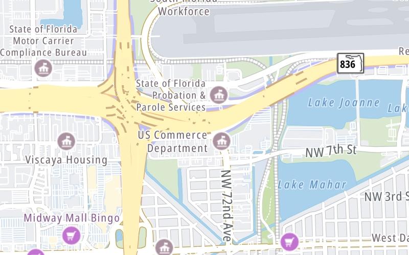
This junction is located in Fontainebleau. Doral and West Miami are nearby.
This location is in the Miami - South Florida area.
This location's approximate GPS Coordinates are 25.77932 x -80.31429.
Which directions can I travel from here?
From this junction, traffic can enter traveling both westbound and eastbound. Traffic can also exit traveling both westbound and eastbound.
On to NW 57th Avenue / Red Road, about 1.5 miles away ►
◄ Back to SR 826 / Palmetto Expressway, about 0.6 miles away.
Which direction are tolls charged here?
The interactive map and lists on this page include key traveler services within two miles of this destination point.
You will find common services, including gas stations, truck stops, EV charging facilities, fast-food or family restaurants, and hotels. These are displayed on the interactive map as markers, which you can select for more information.
Current driving conditions and weather, along with a more complete list of key services, may be found below the map.

Mostly Clear
76°F / 24.4°C
Feels Like:
84°F / 28.7°C
Visibility
10 Mi / 16.1 Km
3-Hour Precip:
0 In / 0.0 Cm
South Southwest
Winds (SSW)
3.5 MPH / 5.6 KPH
Gusts:
4 MPH / 6.5 KPH
▸ Get the full forecast for This Location | The Miami - South Florida area
Conditions and forecasts provided in partnership with AccuWeather.

Weather provided in partnership with AccuWeather.
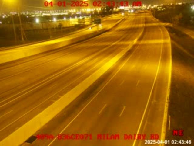
(409A) SR-836 MM071
Camera Direction: EAST. Source: FDOT - undetermined 33126
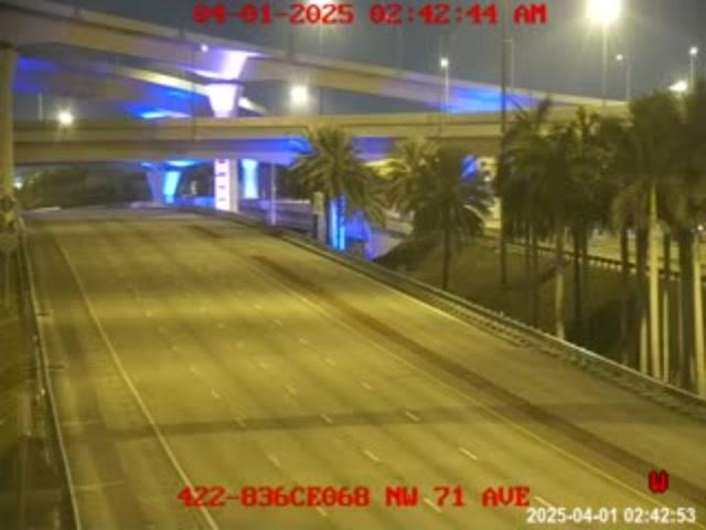
Cameras Closest To NW 72nd Avenue / Milam Dairy Road
615 Ft
954 Ft

1,045 Ft
0.36 Mi
0.41 Mi
There are no currently-available photos for this location.
The map above shows all services within about a two (2) mile radius.

Destination Travel

Closest Gas Stations
COSTCO
7795 W Flagler St • 0.64 miles
Store/Fuel Brand: Costco
CHEVRON
7350 West Flagler Street • 0.67 miles
Store/Fuel Brand: Chevron
EXXON
7100 West Flagler Street • 0.68 miles
Store/Fuel Brand: Exxon
MARATHON
7070 West Flagler Street • 0.69 miles
Store/Fuel Brand: Marathon
Closest EV Chargers
HOLIDAY INN EXPRESS MIAMI AIRPORT
6750 Northwest 7th Street • 0.46 miles
CONNECTOR: IEC62196Type1
POWER: 9 KW @ 208 V
CURRENT: 47 Amp AC1
ROYAL PALMS LUXURY RENTALS
7707 Northwest 7th Street • 0.53 miles
CONNECTOR: IEC62196Type1
POWER: 6 KW @ 208 V
CURRENT: 30 Amp AC1
800 WATERFORD
800 Northwest 62nd Avenue • 0.93 miles
CONNECTOR: IEC62196Type1
POWER: 6 KW @ 208 V
CURRENT: 30 Amp AC1
MIAMI - W FLAGLER ST, FL SUPERCHARGER
7870 West Flagler Street • 0.93 miles
CONNECTOR: Tesla
POWER: 250 KW @ 400 V
CURRENT: 625 Amp DC

Closest Fast Food
Fast food refers ONLY to quick-service and take-out diners. All restaurant types are shown on the map above.
WENDY'S
7555 Northwest 12th Street • 0.38 miles
POLLO TROPICAL
7255 Corporate Center Dr Suite C • 0.85 miles
WAWA
7870 West Flagler Street • 0.88 miles
WENDY'S
7901 West Flagler Street • 0.92 miles
BURGER KING
7955 West Flagler Street • 0.95 miles
MCDONALD'S
7995 West Flagler Street • 0.97 miles
JAMBA
6984 Northwest 12th Street • 1,659 feet
SMOOTHIE SPOT DORAL
8351 Northwest 12th Street • 1.10 miles
Journey to key destinations around and adjacent to Florida!
Communities in this metro area include Destin, Pensacola Beach, Pensacola, Niceville, and Gulf Breeze.
Individual toll maps for this region are listed below.

Communities in this metro area include Jacksonville and Middleburg.
Individual toll maps for this region are listed below.

Communities in this metro area include Apopka, Cocoa, Kissimmee, Lake Buena Vista, Orlando, Saint Cloud, Sanford, Titusville, Melbourne, Poinciana, and Mount Dora.
Individual toll maps for this region are listed below.
Communities in this metro area include Bradenton, Brandon, Saint Petersburg, Spring Hill, and Tampa.
Individual toll maps for this region are listed below.
Communities in this metro area include Fort Pierce, Port Saint Lucie, Stuart, and Vero Beach.
Individual toll maps for this region are listed below.

Communities in this metro area include Fort Lauderdale, Pompano Beach, Hialeah, Opa Locka, Homestead, Kendall, Key Largo, Miramar, Miami, Hollywood, Sunrise, Boca Raton, Delray Beach, West Palm Beach, Jupiter, Davie, Coral Springs, Lake Worth, and Boynton Beach.
Individual toll maps for this region are listed below.
Communities in this metro area include Fort Myers, Naples, and Cape Coral.
Individual toll maps for this region are listed below.
Communities in this metro area include Mobile, Daphne, Dauphin Island, Chickasaw, and Spanish Fort.
Individual toll maps for this region are listed below.

Roads Within Region
 Garcon Point Bridge ▹
 Bob Sikes Bridge ▹
 SR 293 ▹
 First Coast Expressway ▹
 Central Florida Greeneway/Seminole Expy ▹
 Florida's Turnpike ▹
 East West Expressway ▹
 Beachline Expressway ▹
 Western Beltway/Wekiva Pkwy ▹
 Apopka Expressway ▹
 Poinciana Parkway ▹
 SR 453 ▹
 Goldenrod Road Extension ▹
 Osceola Parkway ▹
 SR 451 ▹
 Polk Parkway ▹
 Selmon Expressway ▹
 Suncoast Parkway/Veterans Expy ▹
 Sunshine Skyway ▹
 Pinellas Bayway ▹
 Gateway Expressway ▹
 Airport Expressway ▹
 Alligator Alley ▹
 Dolphin Expressway ▹
 Don Shula Expressway ▹
 Gratigny Parkway ▹
 Sawgrass Expressway ▹
 Snapper Creek Expressway ▹
 Rickenbacker Causeway ▹
 Venetian Causeway ▹
 Card Sound Road ▹
 Sanibel Causeway ▹
 Midpoint Memorial Bridge ▹
 Cape Coral Bridge ▹


