Map & services within two (2) miles
Interactive map shows available cameras, plus nearby fuel, food and lodging


See below for more about this area
Interactive map shows available cameras, plus nearby fuel, food and lodging
See below for more about this area
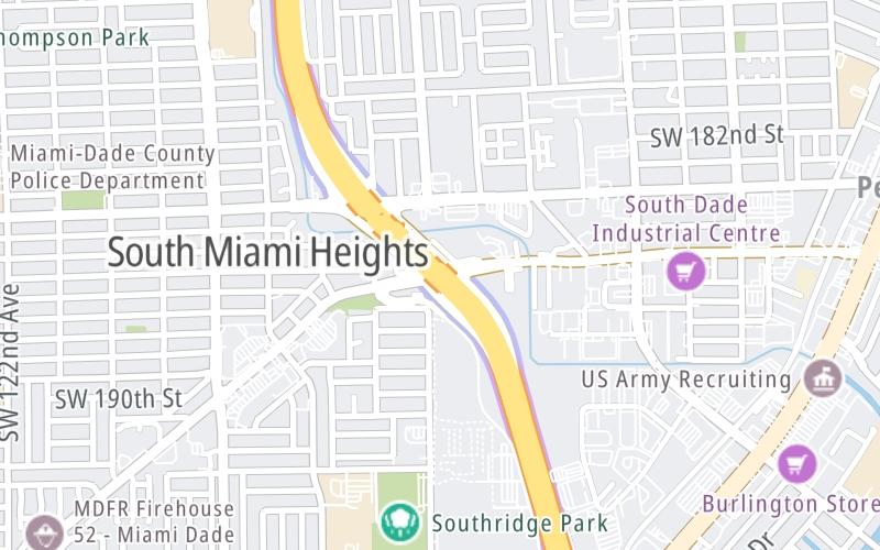
This is Exit 13 of Florida's Turnpike.
This junction is located in Perrine.
This location is in the Miami - South Florida area.
This location's approximate GPS Coordinates are 25.59530 x -80.37210.
Which directions can I travel from here?
From this junction, traffic can enter traveling both southbound and northbound. Traffic can also exit traveling both southbound and northbound.
On to Coral Reef Dr/SW 152nd St/117th Ave / HEFT, about 2.3 miles away ►
◄ Back to Caribbean Blvd/S Dixie Hwy / HEFT, about 1.4 miles away.
Which direction are tolls charged here?
Tolls are not charged or collected at this junction.
Above: Map image © TomTom Intl BVThe interactive map and lists on this page include key traveler services within two miles of this destination point.
You will find common services, including gas stations, truck stops, EV charging facilities, fast-food or family restaurants, and hotels. These are displayed on the interactive map as markers, which you can select for more information.
Current driving conditions and weather, along with a more complete list of key services, may be found below the map.

Partly Cloudy
75°F / 23.9°C
Feels Like:
83°F / 28.1°C
Visibility
10 Mi / 16.1 Km
3-Hour Precip:
0 In / 0.0 Cm
Northeast
Winds (NE)
1.7 MPH / 2.7 KPH
Gusts:
4.2 MPH / 6.8 KPH
▸ Get the full forecast for This Location | The Miami - South Florida area
Conditions and forecasts provided in partnership with AccuWeather.

Weather provided in partnership with AccuWeather.

TPKE MM 13.5 NB B
Camera Direction: NORTH. Source: FDOT - undetermined 33157
Cameras Closest To Quail Roost Dr/Eureka Drive / HEFT
0.35 Mi
0.79 Mi
0.89 Mi
0.91 Mi
1.06 Mi
There are no currently-available photos for this location.
The map above shows all services within about a two (2) mile radius.

Destination Travel

Closest Gas Stations
ORION
10700 Southwest 186th Street • 0.45 miles
Store/Fuel Brand:
CHEVRON
11501 Quail Roost Drive • 0.45 miles
Store/Fuel Brand: Chevron
STOP N SHOP U GAS
10700 Southwest 186th Street • 0.46 miles
Store/Fuel Brand:
SHELL
11690 Quail Roost Drive • 0.59 miles
Store/Fuel Brand: Shell
Closest EV Chargers
CHARGEPOINT
19825 South Dixie Highway • 0.93 miles
CONNECTOR: IEC62196Type1CCS
POWER: 24 KW @ 480 V
CURRENT: 50 Amp DC
BAY POINT RENTALS
18412 Homestead Avenue • 0.96 miles
CONNECTOR: IEC62196Type1
POWER: 9 KW @ V
CURRENT: Amp AC1
CUTLER BAY, FL SUPERCHARGER
11101 Southwest 184th Street • 1,098 feet
CONNECTOR: Tesla
POWER: 250 KW @ 400 V
CURRENT: 625 Amp DC
SORIANO BROTHERS CUBAN CUISINE
18005 South Dixie Highway • 1.38 miles
CONNECTOR: IEC62196Type1
POWER: 10 KW @ 208 V
CURRENT: 50 Amp AC1

Closest Fast Food
Fast food refers ONLY to quick-service and take-out diners. All restaurant types are shown on the map above.
BURGER KING
11400 Quail Roost Drive • 0.43 miles
MCDONALD'S
11575 Quail Roost Drive • 0.48 miles
TACO BELL
11585 Quail Roost Drive • 0.53 miles
KFC
11585 Quail Roost Drive • 0.54 miles
WENDY'S
18880 South Dixie Highway • 0.89 miles
PAPA JOHN'S
19343 South Dixie Highway • 0.92 miles
RAISING CANE'S
19705 South Dixie Highway • 0.92 miles
CHIPOTLE
19151 South Dixie Highway • 0.92 miles
Journey to key destinations around and adjacent to Florida!
Communities in this metro area include Destin, Pensacola Beach, Pensacola, Niceville, and Gulf Breeze.
Individual toll maps for this region are listed below.

Communities in this metro area include Jacksonville and Middleburg.
Individual toll maps for this region are listed below.

Communities in this metro area include Apopka, Cocoa, Kissimmee, Lake Buena Vista, Orlando, Saint Cloud, Sanford, Titusville, Melbourne, Poinciana, and Mount Dora.
Individual toll maps for this region are listed below.
Communities in this metro area include Bradenton, Brandon, Saint Petersburg, Spring Hill, and Tampa.
Individual toll maps for this region are listed below.
Communities in this metro area include Fort Pierce, Port Saint Lucie, Stuart, and Vero Beach.
Individual toll maps for this region are listed below.

Communities in this metro area include Fort Lauderdale, Pompano Beach, Hialeah, Opa Locka, Homestead, Kendall, Key Largo, Miramar, Miami, Hollywood, Sunrise, Boca Raton, Delray Beach, West Palm Beach, Jupiter, Davie, Coral Springs, Lake Worth, and Boynton Beach.
Individual toll maps for this region are listed below.
Communities in this metro area include Fort Myers, Naples, and Cape Coral.
Individual toll maps for this region are listed below.
Communities in this metro area include Mobile, Daphne, Dauphin Island, Chickasaw, and Spanish Fort.
Individual toll maps for this region are listed below.

Roads Within Region
 Garcon Point Bridge ▹
 Bob Sikes Bridge ▹
 SR 293 ▹
 First Coast Expressway ▹
 Central Florida Greeneway/Seminole Expy ▹
 Florida's Turnpike ▹
 East West Expressway ▹
 Beachline Expressway ▹
 Western Beltway/Wekiva Pkwy ▹
 Apopka Expressway ▹
 Poinciana Parkway ▹
 SR 453 ▹
 Goldenrod Road Extension ▹
 Osceola Parkway ▹
 SR 451 ▹
 Polk Parkway ▹
 Selmon Expressway ▹
 Suncoast Parkway/Veterans Expy ▹
 Sunshine Skyway ▹
 Pinellas Bayway ▹
 Gateway Expressway ▹
 Airport Expressway ▹
 Alligator Alley ▹
 Dolphin Expressway ▹
 Don Shula Expressway ▹
 Gratigny Parkway ▹
 Sawgrass Expressway ▹
 Snapper Creek Expressway ▹
 Rickenbacker Causeway ▹
 Venetian Causeway ▹
 Card Sound Road ▹
 Sanibel Causeway ▹
 Midpoint Memorial Bridge ▹
 Cape Coral Bridge ▹


