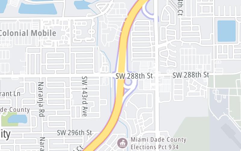
Map & services within two (2) miles
Interactive map shows available cameras, plus nearby fuel, food and lodging


See below for more about this area
Interactive map shows available cameras, plus nearby fuel, food and lodging
See below for more about this area
This is Exit 5 of Florida's Turnpike.
This junction is located in Homestead.
This location is in the Miami - South Florida area.
This location's approximate GPS Coordinates are 25.49950 x -80.41750.
Which directions can I travel from here?
From this junction, traffic can enter traveling both southbound and northbound. Traffic can also exit traveling both southbound and northbound.
On to SW 137th Ave / HEFT, about 0.9 miles away ►
◄ Back to SW 312th St / HEFT, about 2.1 miles away.
Which direction are tolls charged here?
The interactive map and lists on this page include key traveler services within two miles of this destination point.
You will find common services, including gas stations, truck stops, EV charging facilities, fast-food or family restaurants, and hotels. These are displayed on the interactive map as markers, which you can select for more information.
Current driving conditions and weather, along with a more complete list of key services, may be found below the map.

Mostly Clear
77°F / 25°C
Feels Like:
83°F / 28.5°C
Visibility
10 Mi / 16.1 Km
3-Hour Precip:
0 In / 0.0 Cm
South Southeast
Winds (SSE)
4.6 MPH / 7.4 KPH
Gusts:
6.6 MPH / 10.6 KPH
▸ Get the full forecast for This Location | The Miami - South Florida area
Conditions and forecasts provided in partnership with AccuWeather.

Weather provided in partnership with AccuWeather.

TPKE MM 5.1 S OF SW 137TH AVE
Camera Direction: SOUTH. Source: FDOT - undetermined 33033
Cameras Closest To SW 288th St/Biscayne Dr/Homestead Air Base
212 Ft
0.77 Mi
1.03 Mi
2.09 Mi
2.33 Mi
There are no currently-available photos for this location.
The map above shows all services within about a two (2) mile radius.

Destination Travel

Closest Gas Stations
CIRCLE K
13300 Southwest 288th Street • 0.75 miles
Store/Fuel Brand: Circle K
LEISURE CITY EXPREZO
29421 Southwest 152nd Avenue • 1.24 miles
Store/Fuel Brand: Mobil
KWIK STOP
29495 Southwest 152nd Avenue • 1.25 miles
Store/Fuel Brand:
M M GAS & FOOD
13690 Southwest 268th Street • 1.30 miles
Store/Fuel Brand:
Closest EV Chargers
SOCSO
29050 Coral Sea Boulevard • 1.32 miles
CONNECTOR: IEC62196Type1
POWER: 6 KW @ 208 V
CURRENT: 30 Amp AC1
THE HEIGHTS AT CORAL TOWN PARK
14401 Southwest 268th Street • 1.38 miles
CONNECTOR: IEC62196Type1
POWER: 6 KW @ 208 V
CURRENT: 30 Amp AC1
HOMESTEAD HOSPITAL
975 Baptist Way • 1.55 miles
CONNECTOR: IEC62196Type1
POWER: 7 KW @ 240 V
CURRENT: 30 Amp AC1
THE AVENUE
13735 Southwest 262nd Street • 1.70 miles
CONNECTOR: IEC62196Type1
POWER: 11 KW @ 208 V
CURRENT: 30 Amp AC1

Closest Fast Food
Fast food refers ONLY to quick-service and take-out diners. All restaurant types are shown on the map above.
TACO BELL
13610 Southwest 288th Street • 0.39 miles
WENDY'S
13485 Southwest 288th Street • 0.46 miles
POLLO TROPICAL
3094 Northeast 41St Place • 1,211 feet
BURGER KING
28644 Southwest 137th Avenue • 1,659 feet
MCDONALD'S
13690 Southwest 288th Street • 1,848 feet
DOMINO'S
27335 South Dixie Highway • 1.26 miles
POPEYES
27101 South Dixie Highway • 1.33 miles
KRISPY KRUNCHY CHICKEN
26929 South Dixie Highway • 1.37 miles
Journey to key destinations around and adjacent to Florida!
Communities in this metro area include Destin, Pensacola Beach, Pensacola, Niceville, and Gulf Breeze.
Individual toll maps for this region are listed below.

Communities in this metro area include Jacksonville and Middleburg.
Individual toll maps for this region are listed below.

Communities in this metro area include Apopka, Cocoa, Kissimmee, Lake Buena Vista, Orlando, Saint Cloud, Sanford, Titusville, Melbourne, Poinciana, and Mount Dora.
Individual toll maps for this region are listed below.
Communities in this metro area include Bradenton, Brandon, Saint Petersburg, Spring Hill, and Tampa.
Individual toll maps for this region are listed below.
Communities in this metro area include Fort Pierce, Port Saint Lucie, Stuart, and Vero Beach.
Individual toll maps for this region are listed below.

Communities in this metro area include Fort Lauderdale, Pompano Beach, Hialeah, Opa Locka, Homestead, Kendall, Key Largo, Miramar, Miami, Hollywood, Sunrise, Boca Raton, Delray Beach, West Palm Beach, Jupiter, Davie, Coral Springs, Lake Worth, and Boynton Beach.
Individual toll maps for this region are listed below.
Communities in this metro area include Fort Myers, Naples, and Cape Coral.
Individual toll maps for this region are listed below.
Communities in this metro area include Mobile, Daphne, Dauphin Island, Chickasaw, and Spanish Fort.
Individual toll maps for this region are listed below.

Roads Within Region
 Garcon Point Bridge ▹
 Bob Sikes Bridge ▹
 SR 293 ▹
 First Coast Expressway ▹
 Central Florida Greeneway/Seminole Expy ▹
 Florida's Turnpike ▹
 East West Expressway ▹
 Beachline Expressway ▹
 Western Beltway/Wekiva Pkwy ▹
 Apopka Expressway ▹
 Poinciana Parkway ▹
 SR 453 ▹
 Goldenrod Road Extension ▹
 Osceola Parkway ▹
 SR 451 ▹
 Polk Parkway ▹
 Selmon Expressway ▹
 Suncoast Parkway/Veterans Expy ▹
 Sunshine Skyway ▹
 Pinellas Bayway ▹
 Gateway Expressway ▹
 Airport Expressway ▹
 Alligator Alley ▹
 Dolphin Expressway ▹
 Don Shula Expressway ▹
 Gratigny Parkway ▹
 Sawgrass Expressway ▹
 Snapper Creek Expressway ▹
 Rickenbacker Causeway ▹
 Venetian Causeway ▹
 Card Sound Road ▹
 Sanibel Causeway ▹
 Midpoint Memorial Bridge ▹
 Cape Coral Bridge ▹


