San Francisco Bay Area Toll Maps

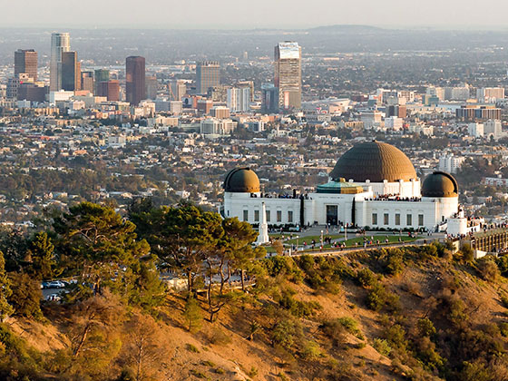
Regional photo of San Francisco Bay Area

Using The Interactive Regional Map

The San Francisco Bay Area metro area map shows exits and toll points for region-wide toll roads or other toll roads that cross the region.

View Map ▾Road List ▾

The following (8) toll roads are in this area, cross through this area or connect with this region:

The San Francisco Bay Area area includes the following cities: San Francisco, San Jose, Sausalito, and Menlo Park.

Markers on the interactive map can be selected to get close-up views of exit points, toll gantries and other locations and points-of-interest. Each POI map shows all nearby dining, gas, EV charging, hotels and other services.

View Map ▾Road List ▾

A complete list of exits and other points-of-interest in the San Francisco Bay Area area follows the map. Exit lists are sorted by toll road.

Advertising
Advertising

Regional Map For San Francisco Bay Area

Pan and zoom as desired. Tap map markers for information and to view that specific location.

A complete list of exits and other points-of-interest is below this map, and other regions are shown further down the page.

Regional photo of San Francisco Bay Area

Visiting In The San Francisco Bay Area Area?

We have partnered with Hotels.com to help you get the best deal on hotels.

Find Hotels

Things to do around San Francisco Bay Area

Things To Do While You're Here

We have partnered with Tiqets to bring you deals on dining and attractions.

Travel Suggestions

Advertising
Advertising

Regional Exits, Listed By Toll Road

A list of all exits and other points-of-interest in this region, sorted by toll road.

CA 4 / John Marsh Heritage Highway

CA 4 / John Marsh Heritage Highway — Antioch

View Map & Info

▸ GPS 37.990474000 X -121.757280000

BATA Bay Area Toll Authority manages this segment.

Main Street / E 18th Street

Exit 1/1AMain Street / E 18th Street — Antioch

View Map & Info

▸ GPS 38.005093000 X -121.753607000
NOTES:

BATA Bay Area Toll Authority manages this segment.

Wilbur Avenue / Bridgehead Road

Exit 1B/1CWilbur Avenue / Bridgehead Road — Antioch

View Map & Info

▸ GPS 38.012240000 X -121.751936000
NOTES:

BATA Bay Area Toll Authority manages this segment.

Antioch Bridge Toll Plaza

Antioch Bridge Toll Plaza — Antioch

View Map & Info

▸ GPS 38.015045000 X -121.751541000
NOTES:

BATA Bay Area Toll Authority manages this segment.

Sherman Island Cross Road

Sherman Island Cross Road — Rio Vista

View Map & Info

▸ GPS 38.058461000 X -121.738759000
NOTES:

BATA Bay Area Toll Authority manages this segment.

Sherman Island Road

Sherman Island Road — Rio Vista

View Map & Info

▸ GPS 38.080134000 X -121.730344000
NOTES:

BATA Bay Area Toll Authority manages this segment.

Three Mile Slough Bridge / East Levee Rd

Three Mile Slough Bridge / East Levee Rd — Rio Vista

View Map & Info

▸ GPS 38.105085000 X -121.701713000
NOTES:

BATA Bay Area Toll Authority manages this segment.

Marina Vista Avenue/Waterfront Road

Exit 56Marina Vista Avenue/Waterfront Road — Martinez

View Map & Info

▸ GPS 38.025544000 X -122.111769000
NOTES:

BATA Bay Area Toll Authority manages this segment.

Benicia–Martinez Bridge Toll Plaz

Benicia–Martinez Bridge Toll Plaz — Martinez

View Map & Info

▸ GPS 38.026943000 X -122.114289000
NOTES:

BATA Bay Area Toll Authority manages this segment.

I–780/I–680 Interchange

Exit 58/58AI–780/I–680 Interchange — Benicia

View Map & Info

▸ GPS 38.049015000 X -122.126507000
NOTES:

BATA Bay Area Toll Authority manages this segment.

Cummings Skyway

Exit 26Cummings Skyway — Crockett

View Map & Info

▸ GPS 38.045141000 X -122.238055000
NOTES:

BATA Bay Area Toll Authority manages this segment.

Pomona Street/San Pablo Avenue

Exit 27Pomona Street/San Pablo Avenue — Crockett

View Map & Info

▸ GPS 38.052624000 X -122.227411000
NOTES:

BATA Bay Area Toll Authority manages this segment.

Carquinez Bridge Toll Plaza

Carquinez Bridge Toll Plaza — Vallejo

View Map & Info

▸ GPS 38.069100000 X -122.226697000
NOTES:

BATA Bay Area Toll Authority manages this segment.

Sonoma Boulevard

Exit 29ASonoma Boulevard — Vallejo

View Map & Info

▸ GPS 38.076410000 X -122.231855000
NOTES: WB On/EB Off

BATA Bay Area Toll Authority manages this segment.

Sequoia Ave

Exit 29BSequoia Ave — Vallejo

View Map & Info

▸ GPS 38.078062000 X -122.232602000
NOTES: No EB On

BATA Bay Area Toll Authority manages this segment.

Magazine Street

Exit 29B/29CMagazine Street — Vallejo

View Map & Info

▸ GPS 38.085263000 X -122.232821000
NOTES:

BATA Bay Area Toll Authority manages this segment.

I–780

Exit 30I–780 — Vallejo

View Map & Info

▸ GPS 38.091527000 X -122.230351000
NOTES:

BATA Bay Area Toll Authority manages this segment.

University Avenue

University Avenue — Menlo Park

View Map & Info

▸ GPS 37.486232000 X -122.142732000
NOTES:

BATA Bay Area Toll Authority manages this segment.

Dumbarton Bridge Tolls

Dumbarton Bridge Tolls — Newark

View Map & Info

▸ GPS 37.535597000 X -122.074998000
NOTES:

BATA Bay Area Toll Authority manages this segment.

Thornton Avenue

Thornton Avenue — Newark

View Map & Info

▸ GPS 37.540178000 X -122.067460000
NOTES:

BATA Bay Area Toll Authority manages this segment.

Welcome Center / Lincoln Boulevard

Exit 439Welcome Center / Lincoln Boulevard — San Francisco

View Map & Info

▸ GPS 37.806500000 X -122.474571000
NOTES:

Golden Gate Bridge Golden Gate Transportation District manages this segment.

Golden Gate Bridge Welcome Center

Golden Gate Bridge Welcome Center — San Francisco

View Map & Info

▸ GPS 37.807336000 X -122.474767000
NOTES:

Golden Gate Bridge Toll Plaza

Golden Gate Bridge Toll Plaza — San Francisco

View Map & Info

▸ GPS 37.835684000 X -122.484646000
NOTES:

Golden Gate Bridge Golden Gate Transportation District manages this segment.

Vista Point / H. Dana Bower Rest Area

Vista Point / H. Dana Bower Rest Area — Fort Baker

View Map & Info

▸ GPS 37.832711000 X -122.481143000
NOTES:

Alexander Avenue / Fort Baker

Exit 442Alexander Avenue / Fort Baker — Fort Baker

View Map & Info

▸ GPS 37.835684000 X -122.484646000
NOTES:

Golden Gate Bridge Golden Gate Transportation District manages this segment.

US 101

Exit 1AUS 101 — San Rafael

View Map & Info

▸ GPS 37.964828000 X -122.514527000
NOTES:

BATA Bay Area Toll Authority manages this segment.

Bellam Boulevard / Francisco Boulevard

Exit 1/1BBellam Boulevard / Francisco Boulevard — San Rafael

View Map & Info

▸ GPS 37.959957000 X -122.505613000
NOTES:

BATA Bay Area Toll Authority manages this segment.

Sir Francis Drake Boulevard

Exit 2ASir Francis Drake Boulevard — San Rafael

View Map & Info

▸ GPS 37.944880000 X -122.488369000
NOTES: WB Off/EB On

BATA Bay Area Toll Authority manages this segment.

San Quentin State Prison / Francisco Blvd E

Exit 2/2BSan Quentin State Prison / Francisco Blvd E — San Quentin

View Map & Info

▸ GPS 37.943433000 X -122.480458000
NOTES:

BATA Bay Area Toll Authority manages this segment.

Richmond Toll Plaza

Richmond Toll Plaza — Richmond

View Map & Info

▸ GPS 37.932456000 X -122.403247000
NOTES:

BATA Bay Area Toll Authority manages this segment.

Stenmark Drive / to Point Molate

Exit 7AStenmark Drive / to Point Molate — Richmond

View Map & Info

▸ GPS 37.932101000 X -122.400174000
NOTES: WB Off/EB On

BATA Bay Area Toll Authority manages this segment.

Richmond Parkway / Castro Blvd

Exit 7/7BRichmond Parkway / Castro Blvd — Richmond

View Map & Info

▸ GPS 37.929137000 X -122.386677000
NOTES:

BATA Bay Area Toll Authority manages this segment.

Canal Boulevard / Richmond Parkway

Exit 8Canal Boulevard / Richmond Parkway — Richmond

View Map & Info

▸ GPS 37.927075000 X -122.378208000
NOTES:

BATA Bay Area Toll Authority manages this segment.

I–80/US 101 NB Exit 433B

Exit 1A/1BI–80/US 101 NB Exit 433B — San Francisco

View Map & Info

▸ GPS 37.765135000 X -122.404824000
NOTES:

BATA Bay Area Toll Authority manages this segment.

Seventh St / 8th/9th Streets

Exit 1/1CSeventh St / 8th/9th Streets — San Francisco

View Map & Info

▸ GPS 37.773232000 X -122.406533000
NOTES:

BATA Bay Area Toll Authority manages this segment.

Fourth Street

Exit 2Fourth Street — San Francisco

View Map & Info

▸ GPS 37.778287000 X -122.400846000
NOTES: WB On/EB Off

BATA Bay Area Toll Authority manages this segment.

Fifth Street

Exit 2AFifth Street — San Francisco

View Map & Info

▸ GPS 37.782209000 X -122.396214000
NOTES: WB Off/EB On

BATA Bay Area Toll Authority manages this segment.

Fremont St / Harrison St

Exit 2B/2CFremont St / Harrison St — San Francisco

View Map & Info

▸ GPS 37.785665000 X -122.391339000
NOTES: WB Off/EB On

BATA Bay Area Toll Authority manages this segment.

Treasure Island West

Exit 4ATreasure Island West — San Francisco

View Map & Info

▸ GPS 37.808300000 X -122.367017000
NOTES: WB On/EB Off

BATA Bay Area Toll Authority manages this segment.

Treasure Island East

Exit 4Treasure Island East — San Francisco

View Map & Info

▸ GPS 37.813229000 X -122.361671000
NOTES: No EB Off

BATA Bay Area Toll Authority manages this segment.

Bay Bridge Toll Plaza

Bay Bridge Toll Plaza — Oakland

View Map & Info

▸ GPS 37.824750000 X -122.313832000
NOTES:

BATA Bay Area Toll Authority manages this segment.

West Grand Ave / I–880

Exit 8AWest Grand Ave / I–880 — Oakland

View Map & Info

▸ GPS 37.824361000 X -122.308623000
NOTES:

BATA Bay Area Toll Authority manages this segment.

I–80 / I–580 Interchange

I–80 / I–580 Interchange — Oakland

View Map & Info

▸ GPS 37.825416000 X -122.303693000
NOTES:

BATA Bay Area Toll Authority manages this segment.

US 101

Exit 13A/BUS 101 — San Mateo

View Map & Info

▸ GPS 37.553095000 X -122.295409000
NOTES:

BATA Bay Area Toll Authority manages this segment.

Edgewater Blvd/Mariners Island Blvd

Exit 14AEdgewater Blvd/Mariners Island Blvd — San Mateo

View Map & Info

▸ GPS 37.557204000 X -122.283543000
NOTES:

BATA Bay Area Toll Authority manages this segment.

Foster City Boulevard

Exit 14BFoster City Boulevard — Foster City

View Map & Info

▸ GPS 37.563031000 X -122.274261000
NOTES:

BATA Bay Area Toll Authority manages this segment.

San Mateo–Hayward Bridge Toll Plaza

San Mateo–Hayward Bridge Toll Plaza — Hayward

View Map & Info

▸ GPS 37.617982000 X -122.152447000
NOTES:

BATA Bay Area Toll Authority manages this segment.

Clawiter Road/Eden Landing Road

Exit 24Clawiter Road/Eden Landing Road — Hayward

View Map & Info

▸ GPS 37.628064000 X -122.121204000
NOTES:

BATA Bay Area Toll Authority manages this segment.

Industrial Boulevard

Exit 25AIndustrial Boulevard — Hayward

View Map & Info

▸ GPS 37.632198000 X -122.110026000
NOTES:

BATA Bay Area Toll Authority manages this segment.

Hesperian Boulevard

Exit 25BHesperian Boulevard — Hayward

View Map & Info

▸ GPS 37.636221000 X -122.099928000
NOTES:

BATA Bay Area Toll Authority manages this segment.

I–880/Nimitz Freeway

Exit 26A/BI–880/Nimitz Freeway — Hayward

View Map & Info

▸ GPS 37.644667000 X -122.093766000
NOTES:

BATA Bay Area Toll Authority manages this segment.

Advertising
Advertising

EXPLORE CALIFORNIA

Journey to key destinations around and adjacent to California!

Map Of This Region ▹

Communities in this metro area include Los Angeles, Long Beach, Irvine, San Juan Capistrano, and Santa Ana.

Individual toll maps for this region are listed below.

Map Of This Region ▹

Communities in this metro area include San Diego, Chula Vista, and Tijuana, Mexico.

Individual toll maps for this region are listed below.

Turnpikes.com is proud to partner with the following: