Map & services within two (2) miles
Interactive map shows available cameras, plus nearby fuel, food and lodging


See below for more about this area
Interactive map shows available cameras, plus nearby fuel, food and lodging
See below for more about this area
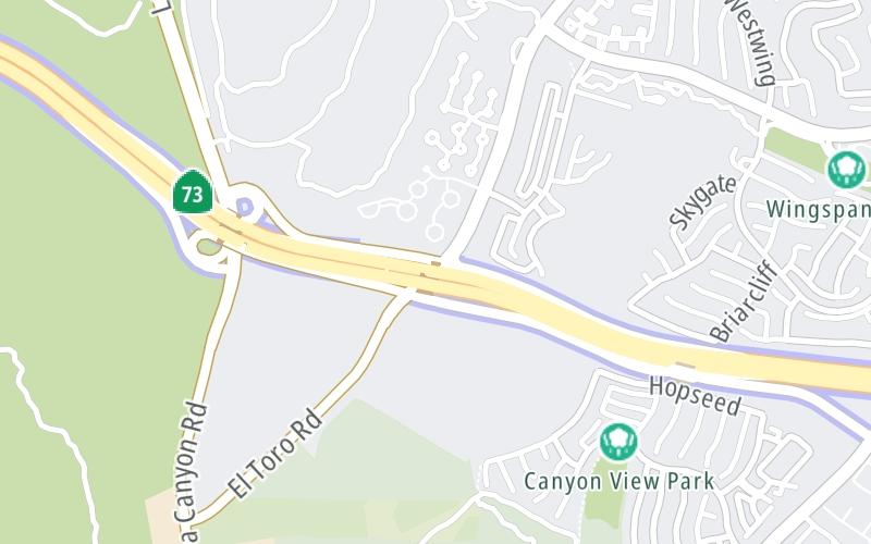
This is Exit 6 of CA 73.
This junction is located in Aliso Viejo. Laguna Hills is nearby.
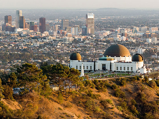
This location is in the Greater Los Angeles area.
This location's approximate GPS Coordinates are 33.59101 x -117.75155.
Which directions can I travel from here?
From this junction, traffic can enter traveling both southbound and northbound. Traffic can also exit traveling both southbound and northbound.
On to Newport Coast Drive, about 5.2 miles away ►
◄ Back to Glenwood Drive/Pacific Park Drive, about 0.9 miles away.
Which direction are tolls charged here?
The interactive map and lists on this page include key traveler services within two miles of this destination point.
You will find common services, including gas stations, truck stops, EV charging facilities, fast-food or family restaurants, and hotels. These are displayed on the interactive map as markers, which you can select for more information.
Current driving conditions and weather, along with a more complete list of key services, may be found below the map.

Mostly Sunny
58°F / 14.5°C
Feels Like:
60°F / 15.5°C
Visibility
15 Mi / 24.1 Km
3-Hour Precip:
0 In / 0.0 Cm
West
Winds (W)
8.9 MPH / 14.3 KPH
Gusts:
16.5 MPH / 26.5 KPH
▸ Get the full forecast for This Location | The Greater Los Angeles area
Conditions and forecasts provided in partnership with AccuWeather.

Weather provided in partnership with AccuWeather.

CA-73 N/O LAGUNA CANYON RD 1
Camera Direction: SOUTH. Source: Caltrans - Los Angeles 92651
Cameras Closest To El Toro Road / Laguna Canyon Road
0.97 Mi
1.91 Mi
2.02 Mi
2.51 Mi
2.82 Mi
There are no currently-available photos for this location.
The map above shows all services within about a two (2) mile radius.

Destination Travel

Closest Gas Stations
CHEVRON
23022 Aliso Creek Road • 1.33 miles
Store/Fuel Brand: Chevron
Closest EV Chargers
CHARGEPOINT
22501 Chase • 1.03 miles
CONNECTOR: IEC62196Type1
POWER: 6 KW @ 240 V
CURRENT: 27 Amp AC1
CHARGEPOINT
2 Enterprise • 1.08 miles
CONNECTOR: IEC62196Type1
POWER: 6 KW @ 240 V
CURRENT: 27 Amp AC1
CHARGEPOINT
15 Enterprise • 1.27 miles
CONNECTOR: IEC62196Type1
POWER: 6 KW @ 240 V
CURRENT: 27 Amp AC1
75 ENTERPRISE
75 Enterprise • 1.53 miles
CONNECTOR: IEC62196Type1
POWER: 7 KW @ 240 V
CURRENT: 30 Amp AC1

Closest Fast Food
Fast food refers ONLY to quick-service and take-out diners. All restaurant types are shown on the map above.
CARL'S JUNIOR
23002 Aliso Creek Road • 1.32 miles
Journey to key destinations around and adjacent to California!
Communities in this metro area include Los Angeles, Long Beach, Irvine, San Juan Capistrano, and Santa Ana.
Individual toll maps for this region are listed below.
Communities in this metro area include San Francisco, San Jose, Sausalito, and Menlo Park.
Individual toll maps for this region are listed below.
Communities in this metro area include San Diego, Chula Vista, and Tijuana, Mexico.
Individual toll maps for this region are listed below.
 CA 73 ▹
 CA 133 ▹
 CA 241 ▹
 CA 261 ▹
 Antioch Bridge ▹
 Benicia Martinez Bridge ▹
 Carquinez Bridge ▹
 Dumbarton Bridge ▹
 Golden Gate Bridge ▹
 Richmond San Rafael Bridge ▹
 San Mateo Hayward Bridge ▹
 South Bay Expressway ▹


