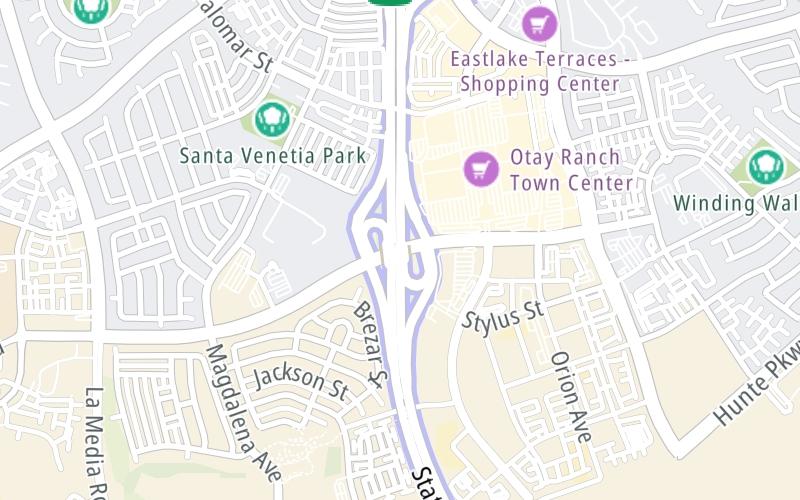
Map & services within two (2) miles
Interactive map shows available cameras, plus nearby fuel, food and lodging


See below for more about this area
Interactive map shows available cameras, plus nearby fuel, food and lodging
See below for more about this area
This is Exit 5 of the South Bay Expressway.
This junction is located in Chula Vista. San Diego is nearby.
This location is in the San Diego area.
This location's approximate GPS Coordinates are 32.62068 x -116.97118.
Which directions can I travel from here?
From this junction, traffic can enter traveling both southbound and northbound. Traffic can also exit traveling both southbound and northbound.
On to Olympic Parkway, about 0.8 miles away ►
◄ Back to Otay Mesa Road / to CA 905, about 4.6 miles away.
Which direction are tolls charged here?
The interactive map and lists on this page include key traveler services within two miles of this destination point.
You will find common services, including gas stations, truck stops, EV charging facilities, fast-food or family restaurants, and hotels. These are displayed on the interactive map as markers, which you can select for more information.
Current driving conditions and weather, along with a more complete list of key services, may be found below the map.

Mostly Cloudy
64°F / 18°C
Feels Like:
72°F / 22.2°C
Visibility
10 Mi / 16.1 Km
3-Hour Precip:
0 In / 0.0 Cm
West Northwest
Winds (WNW)
8.3 MPH / 13.4 KPH
Gusts:
15.2 MPH / 24.5 KPH
▸ Get the full forecast for This Location | The San Diego area
Conditions and forecasts provided in partnership with AccuWeather.

Weather provided in partnership with AccuWeather.
There is no currently-available traffic camera feed for this location.
There are no currently-available photos for this location.
The map above shows all services within about a two (2) mile radius.

Destination Travel

Closest Gas Stations
CHEVRON
2115 Olympic Parkway • 0.63 miles
Store/Fuel Brand: Chevron
7-ELEVEN
1382 East Palomar Street • 1.60 miles
Store/Fuel Brand: 7-Eleven
Closest EV Chargers
OTAY RANCH TOWN CENTER
2015 Birch Road • 0.41 miles
CONNECTOR: IEC62196Type1
POWER: 7 KW @ 240 V
CURRENT: 30 Amp AC1
CHARGEPOINT
1902 Millenia Avenue • 0.65 miles
CONNECTOR: IEC62196Type1
POWER: 6 KW @ 240 V
CURRENT: 27 Amp AC1
AYERS HOTEL CHULA VISTA
1710 Millenia Avenue • 1,029 feet
CONNECTOR: Tesla
POWER: 7 KW @ 240 V
CURRENT: 30 Amp AC1
AYRES HOTEL SAN DIEGO SOUTH - CHULA VISTA
1710 Millenia Avenue • 1,192 feet
CONNECTOR: IEC62196Type1
POWER: 7 KW @ 240 V
CURRENT: 30 Amp AC1

Closest Fast Food
Fast food refers ONLY to quick-service and take-out diners. All restaurant types are shown on the map above.
WETZEL'S PRETZELS
Transit Guideway • 0.38 miles
JERSEY MIKE'S SUBS
2040 Transit Guideway • 0.44 miles
PANDA EXPRESS
2040 Transit Guideway • 0.46 miles
IN-N-OUT BURGER
1725 Eastlake Parkway • 0.53 miles
DOMINO'S
2110 Birch Road • 0.53 miles
NéKTER JUICE BAR
1741 Eastlake Parkway • 0.61 miles
CHICK-FIL-A
2089 Olympic Parkway • 0.64 miles
RUBIO'S
1480 Eastlake Parkway • 0.66 miles
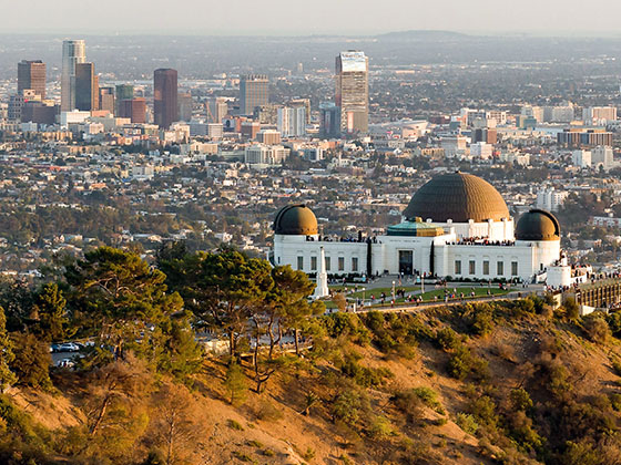
Journey to key destinations around and adjacent to California!
Communities in this metro area include Los Angeles, Long Beach, Irvine, San Juan Capistrano, and Santa Ana.
Individual toll maps for this region are listed below.
Communities in this metro area include San Francisco, San Jose, Sausalito, and Menlo Park.
Individual toll maps for this region are listed below.
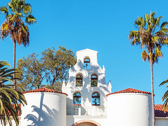
Communities in this metro area include San Diego, Chula Vista, and Tijuana, Mexico.
Individual toll maps for this region are listed below.
 CA 73 ▹
 CA 133 ▹
 CA 241 ▹
 CA 261 ▹
 Antioch Bridge ▹
 Benicia Martinez Bridge ▹
 Carquinez Bridge ▹
 Dumbarton Bridge ▹
 Golden Gate Bridge ▹
 Richmond San Rafael Bridge ▹
 San Mateo Hayward Bridge ▹
 South Bay Expressway ▹


