Seattle - Tacoma Toll Maps

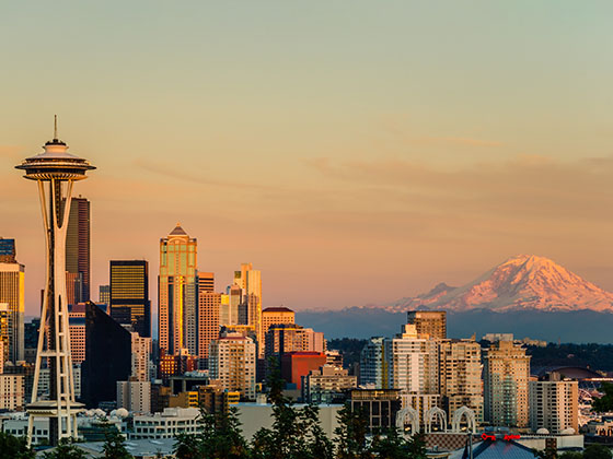
Regional photo of Seattle - Tacoma

Using The Interactive Regional Map

The Seattle - Tacoma metro area map shows exits and toll points for region-wide toll roads or other toll roads that cross the region.

View Map ▾Road List ▾

The following (3) toll roads are in this area, cross through this area or connect with this region:

The Seattle - Tacoma area includes the following cities: Seattle, Tacoma, Bellevue, Redmond, Kirkland, Artondale, and University Place.

Markers on the interactive map can be selected to get close-up views of exit points, toll gantries and other locations and points-of-interest. Each POI map shows all nearby dining, gas, EV charging, hotels and other services.

View Map ▾Road List ▾

A complete list of exits and other points-of-interest in the Seattle - Tacoma area follows the map. Exit lists are sorted by toll road.

Advertising
Advertising

Regional Map For Seattle - Tacoma

Pan and zoom the map as desired, and select or tap the interactive markers to get information about that specific location. Each marker also includes options for viewing a close-up map of the destination point.

A complete list of exits and other points-of-interest is below this map, and other regions are shown further down the page.

Advertising
Advertising

Regional Exits, Listed By Toll Road

A list of all exits and other points-of-interest in this region, sorted by toll road.

Orchard Street / S 19th Street East

Exit 2BOrchard Street / S 19th Street East — Tacoma

View Map & Info

▸ GPS 47.241930000 X -122.504081000
NOTES:

WSDOT Washington State Department of Transportation manages this segment.

S 19th Street West

Exit 2AS 19th Street West — Tacoma

View Map & Info

▸ GPS 47.245648000 X -122.507363000
NOTES:

WSDOT Washington State Department of Transportation manages this segment.

Pearl Street / 6th Avenue

Exit 3Pearl Street / 6th Avenue — Tacoma

View Map & Info

▸ GPS 47.255412000 X -122.514262000
NOTES: EB Pearl/WB 6th

WSDOT Washington State Department of Transportation manages this segment.

N Jackson Avenue

Exit 4N Jackson Avenue — Tacoma

View Map & Info

▸ GPS 47.258643000 X -122.537144000
NOTES:

WSDOT Washington State Department of Transportation manages this segment.

24th Street NW

Exit 824th Street NW — Gig Harbor

View Map & Info

▸ GPS 47.279836000 X -122.561096000
NOTES: No WB Off

WSDOT Washington State Department of Transportation manages this segment.

Tacoma Narrows Bridge Toll Plaza

Tacoma Narrows Bridge Toll Plaza — Gig Harbor

View Map & Info

▸ GPS 47.282225000 X -122.561093000
NOTES:

WSDOT Washington State Department of Transportation manages this segment.

36th Street NW/Otto Jahn Rd

Exit 936th Street NW/Otto Jahn Rd — Gig Harbor

View Map & Info

▸ GPS 47.291721000 X -122.564608000
NOTES: EB Off/EB On

WSDOT Washington State Department of Transportation manages this segment.

Olympic Drive NW

Exit 10Olympic Drive NW — Gig Harbor

View Map & Info

▸ GPS 47.305258000 X -122.576591000
NOTES:

WSDOT Washington State Department of Transportation manages this segment.

South Portal / Alaskan Wy / S Royal Brougham Wy

South Portal / Alaskan Wy / S Royal Brougham Wy — Seattle

View Map & Info

▸ GPS 47.594394000 X -122.335384000
NOTES:

WSDOT Washington State Department of Transportation manages this segment.

North Portal / Dexter Ave / 6th Ave N / Mercer St

North Portal / Dexter Ave / 6th Ave N / Mercer St — Seattle

View Map & Info

▸ GPS 47.622255000 X -122.344386000
NOTES:

WSDOT Washington State Department of Transportation manages this segment.

I–5 / SR 520 Begins

I–5 / SR 520 Begins — Seattle

View Map & Info

▸ GPS 47.642883000 X -122.316945000
NOTES: WB Off/EB On

WSDOT Washington State Department of Transportation manages this segment.

Montlake Boulevard E

Montlake Boulevard E — Seattle

View Map & Info

▸ GPS 47.644269000 X -122.304315000
NOTES:

WSDOT Washington State Department of Transportation manages this segment.

Lake Washington Blvd E / West Side of Bridge

Lake Washington Blvd E / West Side of Bridge — Seattle

View Map & Info

▸ GPS 47.644913000 X -122.291095000
NOTES: WB Off/EB On

WSDOT Washington State Department of Transportation manages this segment.

84th Avenue NE / East Side of Bridge

84th Avenue NE / East Side of Bridge — Hunts Point

View Map & Info

▸ GPS 47.635881000 X -122.227442000
NOTES: WB On/EB Off

WSDOT Washington State Department of Transportation manages this segment.

92nd Avenue NE

92nd Avenue NE — Clyde Hill

View Map & Info

▸ GPS 47.640343000 X -122.217278000
NOTES: WB Off/EB On

WSDOT Washington State Department of Transportation manages this segment.

Lake Washington Blvd NE / Bellevue Way E

Lake Washington Blvd NE / Bellevue Way E — Bellevue

View Map & Info

▸ GPS 47.642161000 X -122.201670000
NOTES: WB On/EB Off

WSDOT Washington State Department of Transportation manages this segment.

108th Avenue NE

108th Avenue NE — Bellevue

View Map & Info

▸ GPS 47.639653000 X -122.196381000
NOTES: No EB Off

WSDOT Washington State Department of Transportation manages this segment.

I–405

I–405 — Bellevue

View Map & Info

▸ GPS 47.632203000 X -122.187957000
NOTES:

WSDOT Washington State Department of Transportation manages this segment.

Advertising
Advertising

EXPLORE WASHINGTON

Journey to key destinations around and adjacent to Washington!

Map Of This Region ▹

Communities in this metro area include Seattle, Tacoma, Bellevue, Redmond, Kirkland, Artondale, and University Place.

Individual toll maps for this region are listed below.

Turnpikes.com is proud to partner with the following: