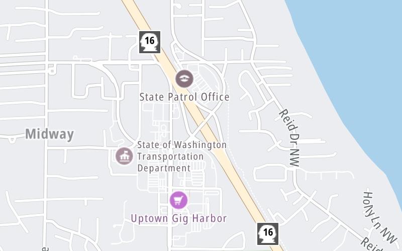
Interactive map shows available cameras, plus nearby fuel, food and lodging
See below for more about this area
This is Exit 10 of the Tacoma Narrows Bridge.
This junction is located in Gig Harbor.
This location is in the Seattle - Tacoma area.
This location's approximate GPS Coordinates are 47.30526 x -122.57659.
Which directions can I travel from here?
From this junction, traffic can enter traveling both westbound and eastbound. Traffic can also exit traveling both westbound and eastbound.
On to 36th Street NW/Otto Jahn Rd, about 1.1 miles away ►
Which direction are tolls charged here?
Tolls are not charged or collected at this junction.
Above: Map image © TomTom Intl BVThe interactive map and lists on this page include key traveler services within two miles of this destination point.
You will find common services, including gas stations, truck stops, EV charging facilities, fast-food or family restaurants, and hotels. These are displayed on the interactive map as markers, which you can select for more information.
Current driving conditions and weather, along with a more complete list of key services, may be found below the map.
Static map. Interactive map is above.Cloudy
48°F / 9°C
Feels Like:
52°F / 11.1°C
Visibility
10 Mi / 16.1 Km
3-Hour Precip:
0.01 In / 0.0 Cm
South Southwest
Winds (SSW)
3.5 MPH / 5.6 KPH
Gusts:
8.1 MPH / 13 KPH
▸ Get the full forecast for This Location | The Seattle - Tacoma area
There is no currently-available traffic camera feed for this location.
There are no currently-available photos for this location.
The map above shows all services within about a two (2) mile radius.
Destination Travel
Closest Gas Stations
GIG HARBOR CHEVRON
5356 Olympic Drive • 0.39 miles
Store/Fuel Brand: Chevron
ARCO
5515 38th Avenue • 0.64 miles
Store/Fuel Brand: Arco
SAFEWAY
4831 Point Fosdick Drive Northwest • 1,097 feet
Store/Fuel Brand: Safeway
CHEVRON
5115 Olympic Drive • 1,149 feet
Store/Fuel Brand: Chevron
Closest EV Chargers
5800 SOUNDVIEW DRIVE
5800 Soundview Drive • 0.43 miles
CONNECTOR: IEC62196Type1
POWER: 11 KW @ 240 V
CURRENT: 48 Amp AC1
KROGER FRED MEYER 691 (GIG HARBOR, WA)
5502 Point Fosdick Drive • 1,031 feet
CONNECTOR: Chademo
POWER: 150 KW @ 400 V
CURRENT: 375 Amp DC
KITSAP BANK - 4714 POINT
4714 Point Fosdick Drive • 1,730 feet
CONNECTOR: IEC62196Type1CCS
POWER: 150 KW @ 950 V
CURRENT: 157 Amp DC
BEST WESTERN PLUS WESLEY INN & SUITES OF GIG HARBOR
6575 Kimball Drive • 1.00 miles
CONNECTOR: Tesla
POWER: 7 KW @ 240 V
CURRENT: 30 Amp AC1
Closest Fast Food
Fast food refers ONLY to quick-service and take-out diners. All restaurant types are shown on the map above.
JIMMY JOHN'S
5114 Point Fosdick Drive • 1,046 feet
CARL'S JUNIOR
5524 Soundview Drive • 1,056 feet
PAPA MURPHY'S
5114 Point Fosdick Drive • 1,058 feet
CHIPOTLE
4823 Point Fosdick Drive Northwest • 1,100 feet
JERSEY MIKES SUBS
4819 Point Fosdick Drive • 1,173 feet
PAPA JOHN'S
5508 Point Fosdick Drive • 1,367 feet
IKONOS REAL GREEK SOUVLAKI
4920 Point Fosdick Drive • 1,433 feet
PANERA BREAD
4751 Point Fosdick Drive • 1,501 feet
Journey to key destinations around and adjacent to Washington!
Communities in this metro area include Seattle, Tacoma, Bellevue, Redmond, Kirkland, Artondale, and University Place.
Individual toll maps for this region are listed below.