Norfolk - Chesapeake Toll Maps

Advertising
Advertising

Toll Road Exit Map For Norfolk - Chesapeake

Pan and zoom as desired. Tap map markers for information and to view that specific location.

Metro and regional information is below. You will also find a list of exits and other points-of-interest in the Norfolk - Chesapeake area. Exit lists below are sorted by the name of the toll road.

Advertising
Advertising

A Quick Look At The Norfolk - Chesapeake Area

Regional photo of Norfolk - Chesapeake

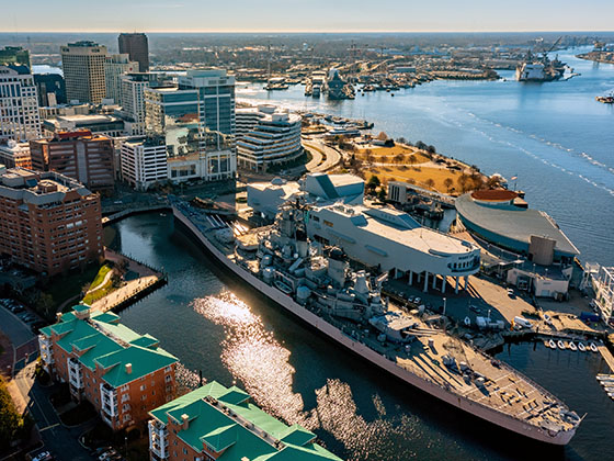
The Norfolk - Chesapeake area includes the following cities: Norfolk, Chesapeake, Virginia Beach, Newport News, Portsmouth, Suffolk, and Moyock, North Carolina.

View Map Road List

What You Will Find On The Regional Map

The interactive metro/regional map above shows exits and toll points for each toll road that is in, or crosses into, the Norfolk - Chesapeake area.

Markers can be selected for a map of that specific exit, toll gantry or other point of interest. Exit maps will show you nearby dining, gas, EV charging, hotels and other services.

The following (6) toll roads are in this area, cross through this area or connect with this region:

Selecting a road will reveal a map of that toll road.

Advertising
Advertising

Discover Virginia Attractions

Turnpikes.com has partnered with Tiqets.com to bring you these excusive deals on attractions!

Advertising
Advertising

Regional Exits, Listed By Toll Road

A list of all exits and other points-of-interest in this region, sorted by toll road.

Shore Drive

Shore Drive — Virginia Beach

View Map & Info

▸ GPS 36.903786000 X -76.129049000
NOTES: Northampton Blvd. at Shore Dr.

CBBT The Chesapeake Bay Bridge and Tunnel District manages this segment.

Island Three

Island Three

View Map & Info

▸ GPS 37.035305000 X -76.078333000
NOTES: Chesapeake Channel Tunnel

CBBT The Chesapeake Bay Bridge and Tunnel District manages this segment.

South Toll Plaza

South Toll Plaza — Virginia Beach

View Map & Info

▸ GPS 36.912234000 X -76.131088000
NOTES: Northbound charged only

CBBT The Chesapeake Bay Bridge and Tunnel District manages this segment.

South Thimble Island / Island One

South Thimble Island / Island One — Virginia Beach

View Map & Info

▸ GPS 36.963688000 X -76.113649000
NOTES: Thimble Shoal Channel Tunnel / Sea Gull Fishing Pier closed for renovation

CBBT The Chesapeake Bay Bridge and Tunnel District manages this segment.

North Thimble Island / Island Two

North Thimble Island / Island Two — Virginia Beach

View Map & Info

▸ GPS 36.983886000 X -76.105346000
NOTES: Thimble Shoal Channel Tunnel

CBBT The Chesapeake Bay Bridge and Tunnel District manages this segment.

Island Four

Island Four

View Map & Info

▸ GPS 37.047568000 X -76.060705000
NOTES: Chesapeake Channel Tunnel

CBBT The Chesapeake Bay Bridge and Tunnel District manages this segment.

Fishermans Island

Fishermans Island — Northampton County

View Map & Info

▸ GPS 37.093941000 X -75.971805000
NOTES: Island crossing only / no stopping

CBBT The Chesapeake Bay Bridge and Tunnel District manages this segment.

Scenic overlook

Scenic overlook — Northampton County

View Map & Info

▸ GPS 37.121399000 X -75.968920000
NOTES: No services / scenic overlook only

CBBT The Chesapeake Bay Bridge and Tunnel District manages this segment.

North Toll Plaza

North Toll Plaza — Northampton County

View Map & Info

▸ GPS 37.132705000 X -75.966836000
NOTES: Southbound charged only

CBBT The Chesapeake Bay Bridge and Tunnel District manages this segment.

Welcome Center

Welcome Center — Cape Charles

View Map & Info

▸ GPS 37.132418000 X -75.965955000
NOTES: Eastern Shore of Virginia Welcome Center

VA 600 / Wise Point Lane

VA 600 / Wise Point Lane — Cape Charles

View Map & Info

▸ GPS 37.138841000 X -75.966947000
NOTES: US 13 at VA 600

CBBT The Chesapeake Bay Bridge and Tunnel District manages this segment.

North Point Blvd. / NC 168

North Point Blvd. / NC 168 — Chesapeake

View Map & Info

▸ GPS 36.550571000 X -76.192741000
NOTES: North Carolina

CTS Chesapeake Transportation System manages this segment.

Neck Road

Neck Road — Chesapeake

View Map & Info

▸ GPS 36.553212000 X -76.194511000
NOTES:

CTS Chesapeake Transportation System manages this segment.

Station Road / Old Battlefield Blvd

Station Road / Old Battlefield Blvd — Chesapeake

View Map & Info

▸ GPS 36.563707000 X -76.199111000
NOTES:

CTS Chesapeake Transportation System manages this segment.

Gallbush Rd / Battlefield Blvd

Gallbush Rd / Battlefield Blvd — Chesapeake

View Map & Info

▸ GPS 36.575089000 X -76.199255000
NOTES: Start/End Tolls

CTS Chesapeake Transportation System manages this segment.

Chesapeake Expressway Main Toll Plaza

Chesapeake Expressway Main Toll Plaza — Chesapeake

View Map & Info

▸ GPS 36.608645000 X -76.204433000
NOTES:

CTS Chesapeake Transportation System manages this segment.

Battlefield Blvd/168 Bus

Exit 5Battlefield Blvd/168 Bus — Chesapeake

View Map & Info

▸ GPS 36.617642000 X -76.211601000
NOTES: SB On/NB Off

CTS Chesapeake Transportation System manages this segment.

Hillcrest Parkway

Exit 8/8A/8BHillcrest Parkway — Chesapeake

View Map & Info

▸ GPS 36.657543000 X -76.229571000
NOTES:

CTS Chesapeake Transportation System manages this segment.

Hanbury Road West/East

Exit 10A/10BHanbury Road West/East — Chesapeake

View Map & Info

▸ GPS 36.688530000 X -76.228074000
NOTES: SB On Use Battlefield Blvd

CTS Chesapeake Transportation System manages this segment.

Mt Pleasant Road

Exit 11/11A/11BMt Pleasant Road — Chesapeake

View Map & Info

▸ GPS 36.707760000 X -76.225877000
NOTES:

CTS Chesapeake Transportation System manages this segment.

Kempsville Road/VA 190 E

Exit 12Kempsville Road/VA 190 E — Chesapeake

View Map & Info

▸ GPS 36.734974000 X -76.236217000
NOTES: NB Off Only

CTS Chesapeake Transportation System manages this segment.

Battlefield Boulevard

Exit 13A/13BBattlefield Boulevard — Chesapeake

View Map & Info

▸ GPS 36.736922000 X -76.241396000
NOTES: Use 13B to Great Bridge

CTS Chesapeake Transportation System manages this segment.

US 17/Dominion Blvd / I–64 East

Exit 15A/15BUS 17/Dominion Blvd / I–64 East — Chesapeake

View Map & Info

▸ GPS 36.756357000 X -76.266575000
NOTES: Use 15A to I–64E

CTS Chesapeake Transportation System manages this segment.

I–64 West / Begin I–464

Exit 1/1A/1BI–64 West / Begin I–464 — Chesapeake

View Map & Info

▸ GPS 36.763031000 X -76.267985000
NOTES: Use 1/1B to I–64W

CTS Chesapeake Transportation System manages this segment.

West Side / Norfolk Naval Shipyard

West Side / Norfolk Naval Shipyard — Portsmouth

View Map & Info

▸ GPS 36.830864000 X -76.302657000

Elizabeth River Tunnels Elizabeth River Crossings manages this segment.

East Side / I–464 / Downtown Norfolk

East Side / I–464 / Downtown Norfolk — Norfolk

View Map & Info

▸ GPS 36.835133000 X -76.287766000
NOTES:

Elizabeth River Tunnels Elizabeth River Crossings manages this segment.

Victory Boulevard / VA 337

Victory Boulevard / VA 337 — Portsmouth

View Map & Info

▸ GPS 36.807791000 X -76.303933000
NOTES:

SNJB South Norfolk Jordan Bridge manages this segment.

Poindexter Street / I–464

Poindexter Street / I–464 — Chesapeake

View Map & Info

▸ GPS 36.812259000 X -76.282332000
NOTES:

SNJB South Norfolk Jordan Bridge manages this segment.

Western Freeway / MLK Freeway

Western Freeway / MLK Freeway — Portsmouth

View Map & Info

▸ GPS 36.852311000 X -76.324503000
NOTES:

Elizabeth River Tunnels Elizabeth River Crossings manages this segment.

Hampton Blvd / Brambleton Ave

Hampton Blvd / Brambleton Ave — Norfolk

View Map & Info

▸ GPS 36.863278000 X -76.306784000
NOTES:

Elizabeth River Tunnels Elizabeth River Crossings manages this segment.

VA 165/Cedar Road / Moses Grandy Trl

VA 165/Cedar Road / Moses Grandy Trl — Chesapeake

View Map & Info

▸ GPS 36.727756000 X -76.302172000
NOTES:

CTS Chesapeake Transportation System manages this segment.

VA 166/Dominion Lakes Blvd / Bainbridge Blvd

VA 166/Dominion Lakes Blvd / Bainbridge Blvd — Chesapeake

View Map & Info

▸ GPS 36.747442000 X -76.284416000
NOTES:

CTS Chesapeake Transportation System manages this segment.

Advertising
Advertising
Regional photo of Norfolk - Chesapeake

Visiting In The Norfolk - Chesapeake Area?

We have partnered with Hotels.com to help you get the best deal on hotels.

Find Hotels

Things to do around Norfolk - Chesapeake

Things To Do While You're Here

We have partnered with Tiqets to bring you deals on dining and attractions.

EXPLORE VIRGINIA

Journey to key destinations around and adjacent to Virginia!

Map Of This Region ▹

Communities in this metro area include Richmond, Meadowbrook, Manchester, and Brandermill.

Individual toll maps for this region are listed below.

Map Of This Region ▹

Communities in this metro area include Norfolk, Chesapeake, Virginia Beach, Newport News, Portsmouth, Suffolk, and Moyock, North Carolina.

Individual toll maps for this region are listed below.

Map Of This Region ▹

Communities in this metro area include Washington, Dc, Fairfax County, Virginia, Loundoun County, Virginia, Montgomery County, Maryland, and Prince George's County, Maryland.

Individual toll maps for this region are listed below.

Map Of This Region ▹

Communities in this metro area include Pittsburgh, Cranberry Township, Beaver Valley, New Castle, Washington, Uniontown, Cheat Lake, West Virginia, Boardman, Ohio, and Youngstown, Ohio.

Individual toll maps for this region are listed below.

Map Of This Region ▹

Communities in this metro area include Charleston, Malden, South Ruffner, and Snow Hill.

Individual toll maps for this region are listed below.

Map Of This Region ▹

Communities in this metro area include Beckley, Beaver, Mac Arthur, Daniels, and Shady Spring.

Individual toll maps for this region are listed below.

Turnpikes.com is proud to partner with the following: