Map & services within two (2) miles
Interactive map shows available cameras, plus nearby fuel, food and lodging


See below for more about this area
Interactive map shows available cameras, plus nearby fuel, food and lodging
See below for more about this area
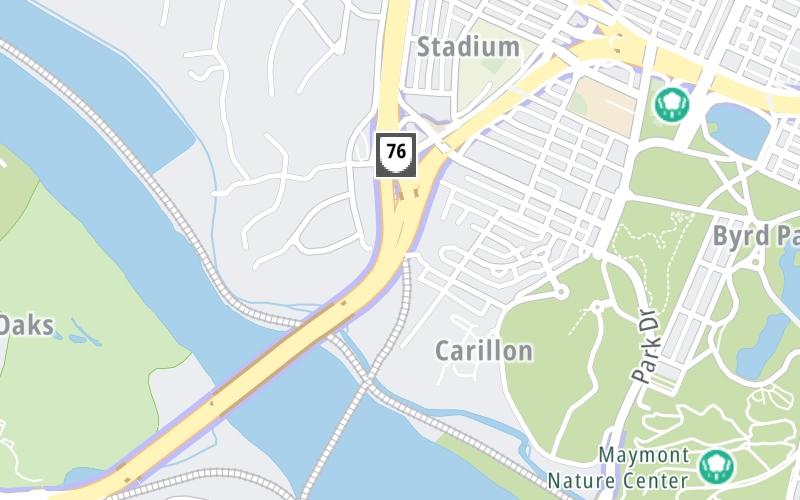
This junction is located in Richmond. NOTE: SB On/NB Off. Access is via the VA 146 spur..
This location is in the Richmond - State Capital area.
This location's approximate GPS Coordinates are 37.54299 x -77.49088.
Which directions can I travel from here?
From this junction, traffic can only enter going southbound. Traffic can only exit going northbound.
On to Douglasdale Road / City Stadium Exit, about 0.3 miles away ►
◄ Back to Forest Hill Avenue / VA 683, about 1.1 miles away.
▹ The Powhite Parkway and the Downtown Expressway connect here.
Which direction are tolls charged here?
Tolls are not charged or collected at this junction.
Above: Photo by Turnpikes.comThe interactive map and lists on this page include key traveler services within two miles of this destination point.
You will find common services, including gas stations, truck stops, EV charging facilities, fast-food or family restaurants, and hotels. These are displayed on the interactive map as markers, which you can select for more information.
Current driving conditions and weather, along with a more complete list of key services, may be found below the map.

Light Rain
63°F / 17.4°C
Feels Like:
62°F / 16.6°C
Visibility
9 Mi / 14.5 Km
3-Hour Precip:
0.18 In / 0.5 Cm
West Southwest
Winds (WSW)
2.3 MPH / 3.6 KPH
Gusts:
7 MPH / 11.2 KPH
▸ Get the full forecast for This Location | The Richmond - State Capital area
Conditions and forecasts provided in partnership with AccuWeather.

Weather provided in partnership with AccuWeather.
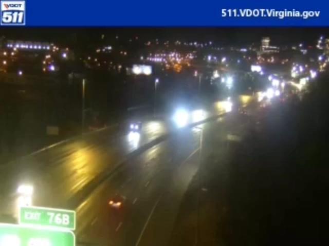
WESTOVER HILLS & FOREST HILL
Camera Direction: WEST. Source: VDOT - Richmond 23225
Cameras Closest To Downtown Expressway / VA 195
1.52 Mi
1.76 Mi

2.26 Mi

2.29 Mi
2.47 Mi
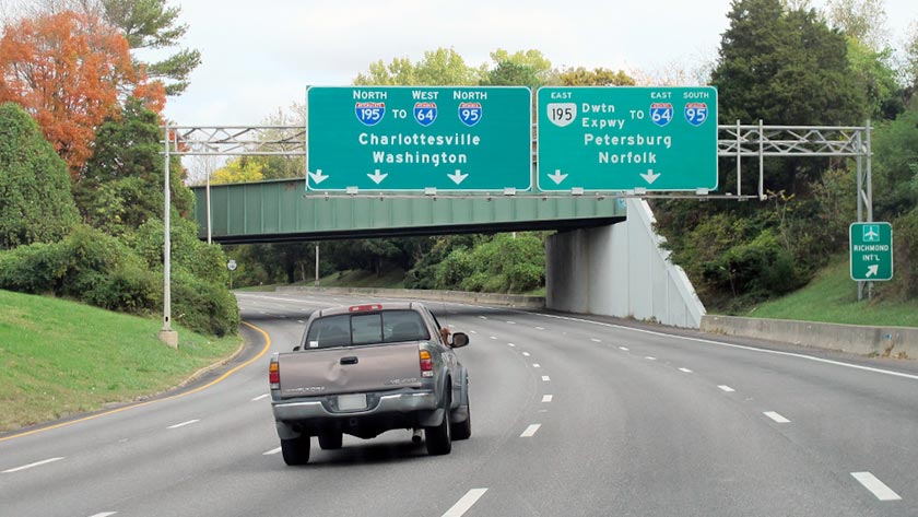
About this photo:
Northbound on the Powhite Parkway approaching the exit to the Downtown Expressway, which appears immediately past the railroad overpass seen in the picture. Photo taken October 29, 2019.
Photo taken 10-29-2019
More Pictures Near Downtown Expressway / VA 195

The map above shows all services within about a two (2) mile radius.

Destination Travel

Closest Gas Stations
CARY STREET BP
1920 West Cary Street • 1.41 miles
Store/Fuel Brand: BP
SHEETZ
2911 Hathaway Road • 1.59 miles
Store/Fuel Brand: Sheetz
DANCE SERVICE CENTER
2906 Hathaway Road • 1.63 miles
Store/Fuel Brand:
FAS MART
1201 Westover Hills Boulevard • 1.64 miles
Store/Fuel Brand: Fas Mart
Closest EV Chargers
SOUTH CRENSHAW AVENUE
10 South Crenshaw Avenue • 0.91 miles
CONNECTOR: Chademo
POWER: 50 KW @ 400 V
CURRENT: 125 Amp DC
PUBLIX #1588
3535 Ellwood Avenue • 0.97 miles
CONNECTOR: IEC62196Type1
POWER: 7 KW @ 240 V
CURRENT: 30 Amp AC1

Closest Fast Food
Fast food refers ONLY to quick-service and take-out diners. All restaurant types are shown on the map above.
CARYTOWN GYRO
3459 West Cary Street • 0.86 miles
MCDONALD'S
3410 West Cary Street • 0.89 miles
RISE-SOUTHERN BISCUITS & RIGHTEOUS CHICKEN
3510 West Cary Street • 0.90 miles
TORCHY'S TACOS
3504 West Cary Street • 0.91 miles
PURE GREEN
3517 Ellwood Avenue • 0.96 miles
CHIPOTLE
10 North Nansemond Street • 0.99 miles
EARLY BIRD BISCUIT COMPANY
119 North Robinson Street • 1.26 miles
KRISPY KRUNCHY CHICKEN
1920 West Cary Street • 1.42 miles
Journey to key destinations around and adjacent to Virginia!
Communities in this metro area include Richmond, Meadowbrook, Manchester, and Brandermill.
Individual toll maps for this region are listed below.
Communities in this metro area include Norfolk, Chesapeake, Virginia Beach, Newport News, Portsmouth, Suffolk, and Moyock, North Carolina.
Individual toll maps for this region are listed below.
Communities in this metro area include Washington, Dc, Fairfax County, Virginia, Loundoun County, Virginia, Montgomery County, Maryland, and Prince George's County, Maryland.
Individual toll maps for this region are listed below.
Communities in this metro area include Pittsburgh, Cranberry Township, Beaver Valley, New Castle, Washington, Uniontown, Cheat Lake, West Virginia, Boardman, Ohio, and Youngstown, Ohio.
Individual toll maps for this region are listed below.
Communities in this metro area include Charleston, Malden, South Ruffner, and Snow Hill.
Individual toll maps for this region are listed below.

Communities in this metro area include Beckley, Beaver, Mac Arthur, Daniels, and Shady Spring.
Individual toll maps for this region are listed below.

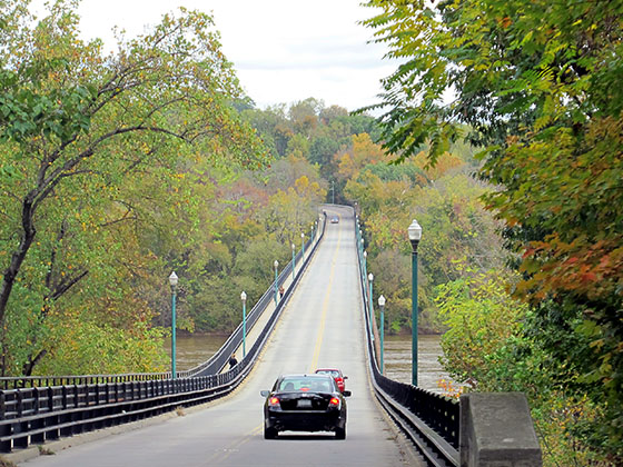
 Boulevard Bridge ▹
 Downtown Expressway ▹
 Pocahontas Parkway ▹
 Powhite Parkway ▹
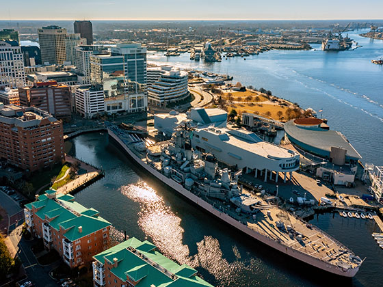
 Chesapeake Bay Bridge Tunnel ▹
 Chesapeake Expressway ▹
 Downtown Tunnel ▹
 South Norfolk Jordan Bridge ▹
 Midtown Tunnel ▹
 Dominion Boulevard Veterans Bridge ▹
 Wm Preston Lane Jr Memorial Bridge ▹
 Intercounty Connector MD 200 ▹
 Dulles Greenway ▹
 PA Turnpike 66 ▹
 Beaver Valley Expressway ▹
 Mon Fayette Expressway ▹
 Pennsylvania Turnpike ▹
 Ohio Turnpike ▹
 PA Turnpike 576 ▹
 West Virginia Turnpike ▹


