Map & services within two (2) miles
Interactive map shows available cameras, plus nearby fuel, food and lodging


See below for more about this area
Interactive map shows available cameras, plus nearby fuel, food and lodging
See below for more about this area
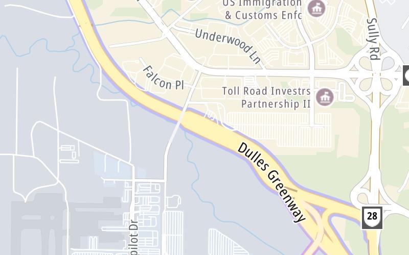
This junction is located in Herndon. Dulles is nearby. NOTE: Dulles Toll Road.
This location's approximate GPS Coordinates are 38.97559 x -77.44352.
Which directions can I travel from here?
From this junction, traffic can enter traveling both westbound and eastbound. Traffic can also exit traveling both westbound and eastbound.
◄ Back to SR 28 South, about 0.1 miles away.
▹ The Dulles Greenway and the Dulles Toll Road connect here.
Which direction are tolls charged here?
Tolls are not charged or collected at this junction.
Above: Map image © TomTom Intl BVThe interactive map and lists on this page include key traveler services within two miles of this destination point.
You will find common services, including gas stations, truck stops, EV charging facilities, fast-food or family restaurants, and hotels. These are displayed on the interactive map as markers, which you can select for more information.
Current driving conditions and weather, along with a more complete list of key services, may be found below the map.

Sunny
55°F / 13°C
Feels Like:
60°F / 15.4°C
Visibility
11 Mi / 17.7 Km
3-Hour Precip:
0 In / 0.0 Cm
North Northwest
Winds (NNW)
4.4 MPH / 7 KPH
Gusts:
8.7 MPH / 14 KPH
▸ Get the full forecast for This Location
Conditions and forecasts provided in partnership with AccuWeather.

Weather provided in partnership with AccuWeather.

VA-28 / MM 41.2 / NB
Camera Direction: NORTH. Source: VDOT - undetermined 20166
Cameras Closest To SR 267
1.18 Mi
2.07 Mi
2.08 Mi
2.54 Mi
3.68 Mi
There are no currently-available photos for this location.
The map above shows all services within about a two (2) mile radius.

Destination Travel

Closest Gas Stations
SHEETZ
22935 Relocation Drive • 0.53 miles
Store/Fuel Brand: Sheetz
SHEETZ
45550 Dulles Plaza • 0.99 miles
Store/Fuel Brand: Sheetz
CLEAN ENERGY - QUARLES - WASHINGTON DULLES INTERNATIONAL AIRPORT
45149 Old Ox Road • 1,681 feet
Store/Fuel Brand: Clean Energy
DULLES SHELL
45410 Holiday Drive • 1.02 miles
Store/Fuel Brand: Shell
Closest EV Chargers
ASURION
22894 Pacific Boulevard • 0.68 miles
CONNECTOR: IEC62196Type1
POWER: 6 KW @ 208 V
CURRENT: 30 Amp AC1
CHARGEPOINT
22760 Pacific Boulevard • 0.93 miles
CONNECTOR: IEC62196Type1
POWER: 6 KW @ 240 V
CURRENT: 27 Amp AC1
SHEETZ 622 (STERLING, VA)
45550 Dulles Plaza • 0.96 miles
CONNECTOR: IEC62196Type1CCS
POWER: 150 KW @ 400 V
CURRENT: 375 Amp DC
LOUDOUN GATEWAY PARKING
22505 Lockridge Road • 1.38 miles
CONNECTOR: IEC62196Type1
POWER: 6 KW @ 240 V
CURRENT: 27 Amp AC1

Closest Fast Food
Fast food refers ONLY to quick-service and take-out diners. All restaurant types are shown on the map above.
THRIVE JUICE
44673 Falcon Place • 0.40 miles
LAREDO TACO COMPANY
44950 Rudder Road • 0.75 miles
WENDY'S
Dulles Access Rd W • 0.97 miles
BURGER KING
45609 Falke Plaza • 1.14 miles
DUNKIN'
45020 Aviation Drive • 1.16 miles
DULLES GOURMET MARKET
1 Saarinen Circle • 1.58 miles
DC-3 HOT DOG JOINT
Saarinen Circle • 1.59 miles
POTBELLY
Saarinen Circle • 1.60 miles
Journey to key destinations around and adjacent to Virginia!
Communities in this metro area include Richmond, Meadowbrook, Manchester, and Brandermill.
Individual toll maps for this region are listed below.
Communities in this metro area include Norfolk, Chesapeake, Virginia Beach, Newport News, Portsmouth, Suffolk, and Moyock, North Carolina.
Individual toll maps for this region are listed below.
Communities in this metro area include Washington, Dc, Fairfax County, Virginia, Loundoun County, Virginia, Montgomery County, Maryland, and Prince George's County, Maryland.
Individual toll maps for this region are listed below.
Communities in this metro area include Pittsburgh, Cranberry Township, Beaver Valley, New Castle, Washington, Uniontown, Cheat Lake, West Virginia, Boardman, Ohio, and Youngstown, Ohio.
Individual toll maps for this region are listed below.
Communities in this metro area include Charleston, Malden, South Ruffner, and Snow Hill.
Individual toll maps for this region are listed below.

Communities in this metro area include Beckley, Beaver, Mac Arthur, Daniels, and Shady Spring.
Individual toll maps for this region are listed below.

 Boulevard Bridge ▹
 Downtown Expressway ▹
 Pocahontas Parkway ▹
 Powhite Parkway ▹
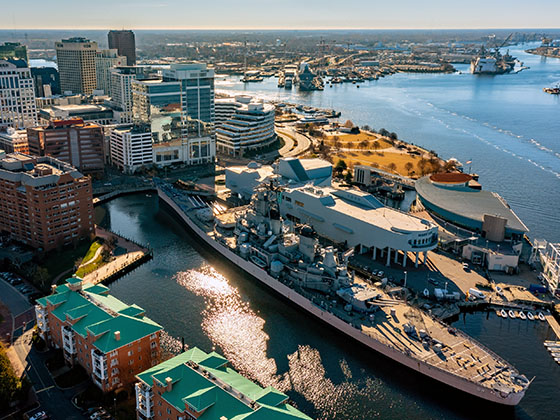
 Chesapeake Bay Bridge Tunnel ▹
 Chesapeake Expressway ▹
 Downtown Tunnel ▹
 South Norfolk Jordan Bridge ▹
 Midtown Tunnel ▹
 Dominion Boulevard Veterans Bridge ▹
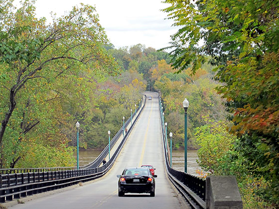
 Wm Preston Lane Jr Memorial Bridge ▹
 Intercounty Connector MD 200 ▹
 Dulles Greenway ▹
 PA Turnpike 66 ▹
 Beaver Valley Expressway ▹
 Mon Fayette Expressway ▹
 Pennsylvania Turnpike ▹
 Ohio Turnpike ▹
 PA Turnpike 576 ▹
 West Virginia Turnpike ▹


