10:39 pm Local Time
Mostly Cloudy
31°F / -0.5°C
Feels Like:
30°F / -1.1°C
Visibility
6 Mi / 9.7 Km
3-Hour Precip:
0.02 In / 0.1 Cm
West Southwest
Winds (WSW)
3.3 MPH / 5.3 KPH
Gusts:
8.5 MPH / 13.6 KPH
Forecast weather and driving conditions follow the jump. These include an hour-by-hour forecast for the next 12-hours, a three-day forecast and an extended forecast, for extended travel planning.
An area traffic map, with available traffic cameras, shows driving conditions, from current traffic to mother nature's influence on the road. These follow the short-range forecasts below.
There is no currently-available traffic camera feed for this location.
Thursday forecast: Much colder with rain and snow showers, accumulating a coating to an inch; any heavier snow shower could briefly reduce visibility
Rain And Snow
96% Chance Rain
40° F/4.4° C
WSW Wind
8 to 23 Mi/
13 to 37 Km
Sunrise
7:17 AM
Thursday night: Much colder with rain and snow showers, accumulating a coating to an inch; any heavier snow shower could briefly reduce visibility
Flurries
10% Chance Rain
30° F/-1.1° C
W Wind
13 to 24 Mi/
20 to 39 Km
Sunset
5:07 PM
Friday forecast: Windy and chilly with rain and snow at times with little or no accumulation, becoming all rain; storm total snowfall an inch or two
Rain And Snow
89% Chance Rain
44° F/6.7° C
W Wind
16 to 35 Mi/
26 to 56 Km
Sunrise
7:18 AM
Friday night: Windy and chilly with rain and snow at times with little or no accumulation, becoming all rain; storm total snowfall an inch or two
Rain And Snow
60% Chance Rain
41° F/5.0° C
WNW Wind
12 to 28 Mi/
19 to 44 Km
Sunset
5:07 PM
Saturday forecast: Breezy in the morning; otherwise, remaining cloudy and chilly
Cloudy
25% Chance Rain
47° F/8.3° C
W Wind
10 to 27 Mi/
17 to 43 Km
Sunrise
7:19 AM
Saturday night: Breezy in the morning; otherwise, remaining cloudy and chilly
Mostly Cloudy
13% Chance Rain
34° F/1.1° C
SW Wind
6 to 13 Mi/
9 to 20 Km
Sunset
5:06 PM
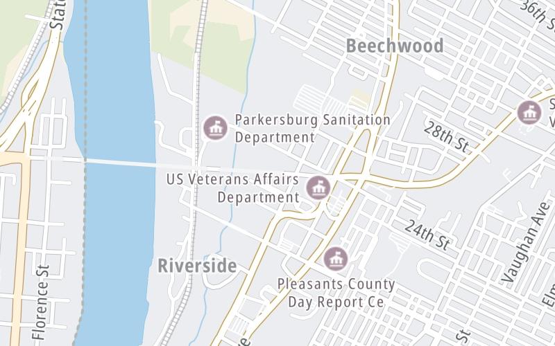
This toll plaza is located in parkersburg, at GPS 39.28282 x -81.55316.
This location is in the Parkersburg - Southeast Ohio area.
The next exit is Ohio Avenue / WV 14, approximately 0.1 miles away ►
◄ The previous exit is Main Street, approximately 0.8 miles away.
Above: Map image © TomTom Intl BVPan and zoom the map as you desire. Select cameras to see on-road traffic feeds; pick exits and other markers for conditions at those locations.
Journey to key destinations around and adjacent to West Virginia!
Communities in this metro area include Charleston, Malden, South Ruffner, and Snow Hill.
Individual toll maps for this region are listed below.
Communities in this metro area include Beckley, Beaver, Mac Arthur, Daniels, and Shady Spring.
Individual toll maps for this region are listed below.
Communities in this metro area include Parkersburg, North Hills, Vienna, and Belpre, Ohio.
Individual toll maps for this region are listed below.
Communities in this metro area include Pittsburgh, Cranberry Township, Beaver Valley, New Castle, Washington, Uniontown, Cheat Lake, West Virginia, Boardman, Ohio, and Youngstown, Ohio.
Individual toll maps for this region are listed below.