Oklahoma State University Toll Maps

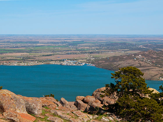
Regional photo of Oklahoma State University

Using The Interactive Regional Map

The Oklahoma State University metro area map shows exits and toll points for region-wide toll roads or other toll roads that cross the region.

View Map ▾Road List ▾

Only the following toll road is in this area:

The Oklahoma State University area includes the following cities: Stillwater and Tulsa.

Markers on the interactive map can be selected to get close-up views of exit points, toll gantries and other locations and points-of-interest. Each POI map shows all nearby dining, gas, EV charging, hotels and other services.

View Map ▾Road List ▾

A complete list of exits and other points-of-interest in the Oklahoma State University area follows the map. Exit lists are sorted by toll road.

Advertising
Advertising

Regional Map For Oklahoma State University

Pan and zoom the map as desired, and select or tap the interactive markers to get information about that specific location. Each marker also includes options for viewing a close-up map of the destination point.

A complete list of exits and other points-of-interest is below this map, and other regions are shown further down the page.

Advertising
Advertising

Regional Exits, Listed By Toll Road

A list of all exits and other points-of-interest in this region, sorted by toll road.

Interstate 35

Exit 1A/BInterstate 35 — Perry

View Map & Info

▸ GPS 36.400172000 X -97.327140000
NOTES: US 412 W to Enid

OTA Oklahoma Turnpike Authority manages this segment.

US 77

Exit 2US 77 — Perry

View Map & Info

▸ GPS 36.398948000 X -97.282705000
NOTES: Airport

OTA Oklahoma Turnpike Authority manages this segment.

US 177

Exit 15US 177 — Perry

View Map & Info

▸ GPS 36.383609000 X -97.067738000
NOTES: Exit doubles as toll barrier

OTA Oklahoma Turnpike Authority manages this segment.

US 177

Exit 20US 177 — Stillwater

View Map & Info

▸ GPS 36.197140000 X -97.069934000
NOTES: Spur

OTA Oklahoma Turnpike Authority manages this segment.

N Perkins Rd

Exit 21AN Perkins Rd — Stillwater

View Map & Info

▸ GPS 36.205334000 X -97.052022000
NOTES: Spur

OTA Oklahoma Turnpike Authority manages this segment.

Stillwater Toll Plaza

Stillwater Toll Plaza — Stillwater

View Map & Info

▸ GPS 36.207049000 X -97.045379000
NOTES: Spur toll plaza

OTA Oklahoma Turnpike Authority manages this segment.

US 64 / Morrison

Exit 22US 64 / Morrison — Morrison

View Map & Info

▸ GPS 36.297694000 X -96.986835000
NOTES: Morrison

OTA Oklahoma Turnpike Authority manages this segment.

Turnpike Spur / Stillwater

Exit 27Turnpike Spur / Stillwater — Glencoe

View Map & Info

▸ GPS 36.240016000 X -96.942987000
NOTES: Spur to Stillwater / Oklahoma State University - WB Off/EB On ONLY

OTA Oklahoma Turnpike Authority manages this segment.

Lone Chimney Concession Plaza

Lone Chimney Concession Plaza — Glencoe

View Map & Info

▸ GPS 36.224831000 X -96.795754000
NOTES: McDonald's / Kum & Go

SH 18 / Pawnee

Exit 37SH 18 / Pawnee — Glencoe

View Map & Info

▸ GPS 36.224823000 X -96.784224000
NOTES: to Pawnee / Cushing

OTA Oklahoma Turnpike Authority manages this segment.

SH 99 / Hallett

Exit 48SH 99 / Hallett — Hallett

View Map & Info

▸ GPS 36.221538000 X -96.574073000
NOTES: Exit doubles as toll barrier

OTA Oklahoma Turnpike Authority manages this segment.

SH 48 / US 64

Exit 59SH 48 / US 64 — Cleveland

View Map & Info

▸ GPS 36.216875000 X -96.381914000
NOTES: Turnpike ends / Begin Sand Springs Expy

OTA Oklahoma Turnpike Authority manages this segment.

Advertising
Advertising

EXPLORE OKLAHOMA

Journey to key destinations around and adjacent to Oklahoma!

Map Of This Region ▹

Communities in this metro area include Tulsa, Broken Arrow, Muskogee, Stillwater, Sapulpa, Vinita, Joplin, Missouri, Siloam Springs, Arkansas, and San Springs.

Individual toll maps for this region are listed below.

Map Of This Region ▹

Communities in this metro area include Stillwater and Tulsa.

Individual toll maps for this region are listed below.

Map Of This Region ▹

Communities in this metro area include Oklahoma City, Choctaw, Norman, Shawnee, Henryetta, Edmond, and Chickasha.

Individual toll maps for this region are listed below.

Map Of This Region ▹

Communities in this metro area include Lawton, Fort Sill, Geronimo, and Cache.

Individual toll maps for this region are listed below.

Map Of This Region ▹

Communities in this metro area include Dallas, Fort Worth, Plano, Addison, Frisco, Grand Prairie, Arlington, Carrrollton, and Lake Dallas.

Individual toll maps for this region are listed below.

Map Of This Region ▹

Communities in this metro area include Wichita, Bel Aire, Andover, Valley Center, and Maize.

Individual toll maps for this region are listed below.

Turnpikes.com is proud to partner with the following: