Map & services within two (2) miles
Interactive map shows available cameras, plus nearby fuel, food and lodging


See below for more about this area
Interactive map shows available cameras, plus nearby fuel, food and lodging
See below for more about this area
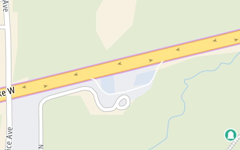
This travel plaza is located in Chandler. NOTE: EB Only.
This location is in the Oklahoma City area.
This location's approximate GPS Coordinates are 35.71954 x -96.88055.
On to Stroud Concession Plaza, about 9.1 miles away ►
◄ Back to SH 18/Price Avenue, about 2.4 miles away.
Above: Map image © TomTom Intl BVThe interactive map and lists on this page include key traveler services within two miles of this destination point.
You will find common services, including gas stations, truck stops, EV charging facilities, fast-food or family restaurants, and hotels. These are displayed on the interactive map as markers, which you can select for more information.
Current driving conditions and weather, along with a more complete list of key services, may be found below the map.

Cloudy
71°F / 21.7°C
Feels Like:
68°F / 20°C
Visibility
10 Mi / 16.1 Km
3-Hour Precip:
0 In / 0.0 Cm
South
Winds (S)
16.4 MPH / 26.3 KPH
Gusts:
28.6 MPH / 46 KPH
▸ Get the full forecast for This Location | The Oklahoma City area
Conditions and forecasts provided in partnership with AccuWeather.

Weather provided in partnership with AccuWeather.
There is no currently-available traffic camera feed for this location.
There are no currently-available photos for this location.
The map above shows all services within about a two (2) mile radius.

Destination Travel

Closest Gas Stations
NS QUICK STOP
310 West 1st Street • 0.66 miles
Store/Fuel Brand: Quick Stop
ONCUE EXPRESS
501 East 1st Street • 0.71 miles
Store/Fuel Brand: Oncue Express
ON THE WAY 2
1608 East 1st Street • 1.19 miles
Store/Fuel Brand: Conoco
BRICK HILL
120 West 15th Street • 1.66 miles
Store/Fuel Brand:
Closest EV Chargers
WILLIAMS FOOD - CHANDLER
1812 East 1st Street • 1.23 miles
CONNECTOR: Chademo
POWER: 50 KW @ 400 V
CURRENT: 125 Amp DC

Closest Fast Food
Fast food refers ONLY to quick-service and take-out diners. All restaurant types are shown on the map above.
KRISPY KRUNCHY CHICKEN
310 West 1st Street • 0.67 miles
TACO MAYO
604 East 1st Street • 0.74 miles
SONIC
809 East 1st Street • 0.85 miles
MCDONALD'S
1818 East 1st Street • 1.32 miles
MCDONALD'S
346480 East 890 Road • 1.71 miles
Journey to key destinations around and adjacent to Oklahoma!
Communities in this metro area include Tulsa, Broken Arrow, Muskogee, Stillwater, Sapulpa, Vinita, Joplin, Missouri, Siloam Springs, Arkansas, and San Springs.
Individual toll maps for this region are listed below.
Communities in this metro area include Stillwater and Tulsa.
Individual toll maps for this region are listed below.

Communities in this metro area include Oklahoma City, Choctaw, Norman, Shawnee, Henryetta, Edmond, and Chickasha.
Individual toll maps for this region are listed below.
Communities in this metro area include Lawton, Fort Sill, Geronimo, and Cache.
Individual toll maps for this region are listed below.

Communities in this metro area include Dallas, Fort Worth, Plano, Addison, Frisco, Grand Prairie, Arlington, Carrrollton, and Lake Dallas.
Individual toll maps for this region are listed below.
Communities in this metro area include Wichita, Bel Aire, Andover, Valley Center, and Maize.
Individual toll maps for this region are listed below.


 Cimarron Turnpike ▹
 Creek Turnpike ▹
 Muskogee Turnpike ▹
 Turner Turnpike ▹
 Will Rogers Turnpike ▹
 Gilcrease Expressway West ▹
 H E Bailey Turnpike ▹
 Indian Nation Turnpike ▹
 John Kilpatrick Turnpike ▹
 Kickapoo Turnpike ▹
 Chickasaw Turnpike ▹
 Addison Airport Toll Tunnel ▹
 Chisholm Trail Parkway ▹
 Dallas North Tollway ▹
 Lewisville Lake Toll Bridge ▹
 Mountain Creek Lake Toll Bridge ▹
 President George Bush Turnpike ▹
 Sam Rayburn Tollway ▹
 360 Tollway ▹
 Kansas Turnpike ▹


