Map & services within two (2) miles
Interactive map shows available cameras, plus nearby fuel, food and lodging


See below for more about this area
Interactive map shows available cameras, plus nearby fuel, food and lodging
See below for more about this area
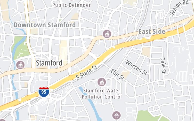
This is Exit 7 of the Connecticut Turnpike.
This junction is located in Stamford. NOTE: to CT 137.
This location's approximate GPS Coordinates are 41.05217 x -73.53102.
Which directions can I travel from here?
From this junction, traffic can only enter going northbound. Traffic can only exit going southbound.
On to Elm Street, about 0.5 miles away ►
◄ Back to Atlantic Street / Canal Street, about 0.7 miles away.
Which direction are tolls charged here?
Tolls are not charged or collected at this junction.
Above: Map image © TomTom Intl BVThe interactive map and lists on this page include key traveler services within two miles of this destination point.
You will find common services, including gas stations, truck stops, EV charging facilities, fast-food or family restaurants, and hotels. These are displayed on the interactive map as markers, which you can select for more information.
Current driving conditions and weather, along with a more complete list of key services, may be found below the map.

Sunny
53°F / 11.4°C
Feels Like:
53°F / 11.8°C
Visibility
15 Mi / 24.1 Km
3-Hour Precip:
0 In / 0.0 Cm
North Northwest
Winds (NNW)
5.6 MPH / 9 KPH
Gusts:
12.1 MPH / 19.6 KPH
▸ Get the full forecast for This Location
Conditions and forecasts provided in partnership with AccuWeather.

Weather provided in partnership with AccuWeather.

I-95 N/O ELM ST
Camera Direction: SOUTH. Source: ConnDOT - Bridgeport 06901
Cameras Closest To Atlantic Street
799 Ft
1.07 Mi
1.70 Mi
3.03 Mi
There are no currently-available photos for this location.
The map above shows all services within about a two (2) mile radius.

Destination Travel

Closest Gas Stations
SHELL
179 Shippan Avenue • 0.41 miles
Store/Fuel Brand: Shell
FAMILY EXPRESS MULTI-SERVICES
130 Frederick Street • 0.52 miles
Store/Fuel Brand: Family Express
DE MOTT AUTO
553 South Pacific Street • 0.55 miles
Store/Fuel Brand:
MINI MART
314 Cove Road • 0.66 miles
Store/Fuel Brand:
Closest EV Chargers
RMS COMPANIES
154 West Broad Street • 0.38 miles
CONNECTOR: IEC62196Type1
POWER: 13 KW @ 240 V
CURRENT: 32 Amp AC1
BEDFORD STREET GARAGE
17 Forest Street • 0.42 miles
CONNECTOR: IEC62196Type1
POWER: 7 KW @ 240 V
CURRENT: 30 Amp AC1
RFR 300 ATLANTIC
300 Atlantic Street • 0.43 miles
CONNECTOR: IEC62196Type1
POWER: 7 KW @ 240 V
CURRENT: 30 Amp AC1
LANDMARK SQUARE
2 Landmark Square • 0.45 miles
CONNECTOR: IEC62196Type1
POWER: 7 KW @ 240 V
CURRENT: 30 Amp AC1

Closest Fast Food
Fast food refers ONLY to quick-service and take-out diners. All restaurant types are shown on the map above.
TOMATILLO TACO JOINT
114 Broad Street • 0.45 miles
JUICE KINGS
36 Atlantic St Retail • 0.45 miles
DUNKIN'
450 Main Street • 0.46 miles
MCDONALD'S
25 Bedford Street • 0.46 miles
LORCA COFFEE BAR
Bedford Street • 0.47 miles
BUFFALO WILD WINGS
208 Summer Street • 0.54 miles
GARDEN CATERING-STAMFORD
235 Main Street • 0.54 miles
THE BRUNCH BOX
119 Towne Street • 0.55 miles
Journey to key destinations around and adjacent to Connecticut!
Communities in this metro area include New Haven, Bridgeport, Darien, Greenwich, Stamford, and Port Chester, New York.
Individual toll maps for this region are listed below.

Communities in this metro area include Springfield, West Springfield, Chicopee, Westfield, and Hartford, Connecticut.
Individual toll maps for this region are listed below.

 Connecticut Turnpike ▹
 Massachusetts Turnpike ▹


