Map & services within two (2) miles
Interactive map shows available cameras, plus nearby fuel, food and lodging


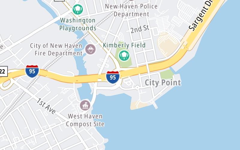
See below for more about this area
Interactive map shows available cameras, plus nearby fuel, food and lodging
See below for more about this area
This is Exit 44 of the Connecticut Turnpike.
This junction is located in New Haven.
This location is in the New Haven - Bridgeport area.
This location's approximate GPS Coordinates are 41.28393 x -72.93451.
Which directions can I travel from here?
From this junction, traffic can enter traveling both southbound and northbound. Traffic can also exit traveling both southbound and northbound.
On to Long Wharf Drive / Sargent Drive, about 0.8 miles away ►
◄ Back to CT 122/1st Avenue, about 1.2 miles away.
Which direction are tolls charged here?
Tolls are not charged or collected at this junction.
Above: Map image © TomTom Intl BVThe interactive map and lists on this page include key traveler services within two miles of this destination point.
You will find common services, including gas stations, truck stops, EV charging facilities, fast-food or family restaurants, and hotels. These are displayed on the interactive map as markers, which you can select for more information.
Current driving conditions and weather, along with a more complete list of key services, may be found below the map.

Partly Cloudy
54°F / 12°C
Feels Like:
55°F / 12.6°C
Visibility
10 Mi / 16.1 Km
3-Hour Precip:
0 In / 0.0 Cm
South
Winds (S)
2.4 MPH / 3.9 KPH
Gusts:
6.1 MPH / 9.8 KPH
▸ Get the full forecast for This Location | The New Haven - Bridgeport area
Conditions and forecasts provided in partnership with AccuWeather.

Weather provided in partnership with AccuWeather.

I-95 S/O LONG WHARF DR
Camera Direction: NORTH. Source: ConnDOT - New Haven 06511
Cameras Closest To CT 10/Ella Grasso Boulevard
0.42 Mi
0.77 Mi
1.76 Mi
1.78 Mi
1.88 Mi
There are no currently-available photos for this location.
The map above shows all services within about a two (2) mile radius.

Destination Travel

Closest Gas Stations
S AND S MINIMART
62 Elm Street • 0.49 miles
Store/Fuel Brand: Citgo
SAMS FOOD STORE
14 Kimberly Avenue • 0.54 miles
Store/Fuel Brand: Sam's
XTRAMART
750 1st Avenue • 0.88 miles
Store/Fuel Brand: Extramart
LONG WHARF MOBIL
200 Sargent Drive • 0.98 miles
Store/Fuel Brand: Mobil
Closest EV Chargers
CHARGEPOINT
40 Union Avenue • 1.01 miles
CONNECTOR: IEC62196Type1
POWER: 6 KW @ 240 V
CURRENT: 27 Amp AC1
CHARGEPOINT
10 Amistad Street • 1.12 miles
CONNECTOR: IEC62196Type1
POWER: 6 KW @ 240 V
CURRENT: 27 Amp AC1
WEST HAVEN CITY HALL
355 Main Street • 1.15 miles
CONNECTOR: IEC62196Type1
POWER: 9 KW @ 240 V
CURRENT: 40 Amp AC1
GATEWAY GARAGE
73 South Orange Street • 1.16 miles
CONNECTOR: IEC62196Type1
POWER: 7 KW @ 240 V
CURRENT: 30 Amp AC1

Closest Fast Food
Fast food refers ONLY to quick-service and take-out diners. All restaurant types are shown on the map above.
SANDBAR
31 Kimberly Avenue • 0.38 miles
HUMMEL BROTHERS
180 Sargent Drive • 0.98 miles
BURGER KING
644 Campbell Avenue • 1.13 miles
MCDONALD'S
1129 Campbell Avenue • 1.30 miles
DAIRY QUEEN
64 Orange Avenue • 1.32 miles
CEDARHURST CAFE
44 Crown Street • 1.46 miles
CAFE GEORGE BY PAULA
300 George Street • 1.48 miles
T-SWIRL CREPE
198 College Street • 1.53 miles
Journey to key destinations around and adjacent to Connecticut!
Communities in this metro area include New Haven, Bridgeport, Darien, Greenwich, Stamford, and Port Chester, New York.
Individual toll maps for this region are listed below.

Communities in this metro area include Springfield, West Springfield, Chicopee, Westfield, and Hartford, Connecticut.
Individual toll maps for this region are listed below.

 Connecticut Turnpike ▹
 Massachusetts Turnpike ▹


