Interactive map shows available cameras, plus nearby fuel, food and lodging
See below for more about this area
This is Exit 31 of the Connecticut Turnpike.
This junction is located in Stratford. NOTE: NB On/SB Off.
This location is in the New Haven - Bridgeport area.
This location's approximate GPS Coordinates are 41.18537 x -73.13822.
Which directions can I travel from here?
From this junction, traffic can only enter going northbound. Traffic can only exit going southbound.
On to Broad Street, about 0.5 miles away ►
◄ Back to Honeyspot Road, about 0.2 miles away.
Which direction are tolls charged here?
Tolls are not charged or collected at this junction.
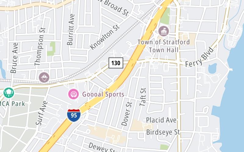
Above: Map image © TomTom Intl BVThe interactive map and lists on this page include key traveler services within two miles of this destination point.
You will find common services, including gas stations, truck stops, EV charging facilities, fast-food or family restaurants, and hotels. These are displayed on the interactive map as markers, which you can select for more information.
Current driving conditions and weather, along with a more complete list of key services, may be found below the map.
Static map. Interactive map is above.Cloudy
50°F / 10°C
Feels Like:
47°F / 8.4°C
Visibility
10 Mi / 16.1 Km
3-Hour Precip:
0 In / 0.0 Cm
West Northwest
Winds (WNW)
9 MPH / 14.5 KPH
Gusts:
19 MPH / 30.6 KPH
▸ Get the full forecast for This Location | The New Haven - Bridgeport area
The map above shows all services within about a two (2) mile radius.
Destination Travel
Closest Gas Stations
HONEYSPOT
245 Honeyspot Road • 0.38 miles
Store/Fuel Brand: Gulf
SKY LIGHT MINI MART
1056 Stratford Avenue • 0.39 miles
Store/Fuel Brand:
CUMBERLAND FARMS
1290 West Broad Street • 0.44 miles
Store/Fuel Brand: Cumberland Farms
MERIT GAS STATION
1975 Barnum Avenue • 0.69 miles
Store/Fuel Brand:
Closest EV Chargers
D & M MANSON ELECTRIC CO
157 Charles Street • 0.91 miles
CONNECTOR: IEC62196Type1
POWER: 7 KW @ 240 V
CURRENT: 30 Amp AC1
STRATFORD SQUARE
411 Barnum Avenue Cutoff • 1.21 miles
CONNECTOR: Chademo
POWER: 150 KW @ 400 V
CURRENT: 375 Amp DC
800 UNION AVENUE
800 Union Avenue • 1.40 miles
CONNECTOR: IEC62196Type1
POWER: 9 KW @ 208 V
CURRENT: 46 Amp AC1
726 UNION AVENUE
726 Union Avenue • 1.41 miles
CONNECTOR: IEC62196Type1
POWER: 9 KW @ 208 V
CURRENT: 46 Amp AC1
Closest Fast Food
Fast food refers ONLY to quick-service and take-out diners. All restaurant types are shown on the map above.
DUNKIN'
1275 West Broad Street • 0.40 miles
LOBSTERCRAFT
2377 Main Street • 0.66 miles
BALTYK DELI
2505 Main Street • 0.70 miles
KRISPY KRUNCHY CHICKEN
1796 Barnum Avenue • 0.70 miles
DOMINO'S
1802 Barnum Avenue • 0.70 miles
UBERTI'S FISH MARKET
88 Ferry Boulevard • 0.72 miles
BURGER KING
1540 Barnum Avenue • 0.73 miles
DQ GRILL & CHILL
1514 Barnum Avenue • 0.74 miles
Journey to key destinations around and adjacent to Connecticut!
Communities in this metro area include New Haven, Bridgeport, Darien, Greenwich, Stamford, and Port Chester, New York.
Individual toll maps for this region are listed below.
Communities in this metro area include Springfield, West Springfield, Chicopee, Westfield, and Hartford, Connecticut.
Individual toll maps for this region are listed below.