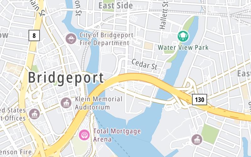
Map & services within two (2) miles
Interactive map shows available cameras, plus nearby fuel, food and lodging


See below for more about this area
Interactive map shows available cameras, plus nearby fuel, food and lodging
See below for more about this area
This is Exit 28 of the Connecticut Turnpike.
This junction is located in Bridgeport. NOTE: NB Off/SB On.
This location is in the New Haven - Bridgeport area.
This location's approximate GPS Coordinates are 41.17902 x -73.18125.
Which directions can I travel from here?
From this junction, traffic can only enter going southbound. Traffic can only exit going northbound.
On to CT 130/Stratford Ave / Seaview Ave, about 0.4 miles away ►
◄ Back to Lafayette Boulevard, about 0.4 miles away.
Which direction are tolls charged here?
Tolls are not charged or collected at this junction.
Above: Map image © TomTom Intl BVThe interactive map and lists on this page include key traveler services within two miles of this destination point.
You will find common services, including gas stations, truck stops, EV charging facilities, fast-food or family restaurants, and hotels. These are displayed on the interactive map as markers, which you can select for more information.
Current driving conditions and weather, along with a more complete list of key services, may be found below the map.

Sunny
64°F / 17.5°C
Feels Like:
71°F / 21.6°C
Visibility
25 Mi / 40.2 Km
3-Hour Precip:
0 In / 0.0 Cm
North Northwest
Winds (NNW)
4.5 MPH / 7.3 KPH
Gusts:
9.4 MPH / 15.2 KPH
▸ Get the full forecast for This Location | The New Haven - Bridgeport area
Conditions and forecasts provided in partnership with AccuWeather.

Weather provided in partnership with AccuWeather.

I-95 @ PEMBROKE ST
Camera Direction: SOUTH. Source: ConnDOT - Bridgeport 06607
Cameras Closest To East Main Street/CT 127
426 Ft
0.52 Mi
0.79 Mi
0.90 Mi
1.35 Mi
There are no currently-available photos for this location.
The map above shows all services within about a two (2) mile radius.

Destination Travel

Closest Gas Stations
SUNOCO
1025 East Main Street • 0.65 miles
Store/Fuel Brand: Sunoco
EAGLE GAS
605 Washington Avenue • 0.75 miles
Store/Fuel Brand:
UNITED RENTALS - CUSTOMER EQUIPMENT SOLUTIONS
552 Housatonic Avenue • 0.89 miles
Store/Fuel Brand: United
JOSE UNSO MINI MARKET
373 Harral Avenue • 0.91 miles
Store/Fuel Brand:
Closest EV Chargers
855 MAIN STREET
855 Main Street • 0.45 miles
CONNECTOR: IEC62196Type1
POWER: 7 KW @ 240 V
CURRENT: 30 Amp AC1
HARBOR YARD AMPHITHEATER
500 Broad Street • 0.60 miles
CONNECTOR: IEC62196Type1
POWER: 9 KW @ 240 V
CURRENT: 40 Amp AC1
726 UNION AVENUE
726 Union Avenue • 0.87 miles
CONNECTOR: IEC62196Type1
POWER: 9 KW @ 208 V
CURRENT: 46 Amp AC1
800 UNION AVENUE
800 Union Avenue • 0.89 miles
CONNECTOR: IEC62196Type1
POWER: 9 KW @ 208 V
CURRENT: 46 Amp AC1

Closest Fast Food
Fast food refers ONLY to quick-service and take-out diners. All restaurant types are shown on the map above.
MOE'S BURGER JOINT
997 Main Street • 0.42 miles
MCDONALD'S
1025 Main Street • 0.43 miles
BAGEL KING
276 Fairfield Avenue • 0.58 miles
P 1 JUICE BAR
1765 Main Street • 0.92 miles
LOS SANDWICHES DEL BORI
474 Putnam Street • 1.06 miles
CRUNCH N' MUNCH
54 Wood Avenue • 1.10 miles
CHESTER'S
1449 Boston Avenue • 1.26 miles
MCDONALD'S
1700 Park Avenue • 1.33 miles
Journey to key destinations around and adjacent to Connecticut!
Communities in this metro area include New Haven, Bridgeport, Darien, Greenwich, Stamford, and Port Chester, New York.
Individual toll maps for this region are listed below.

Communities in this metro area include Springfield, West Springfield, Chicopee, Westfield, and Hartford, Connecticut.
Individual toll maps for this region are listed below.

 Connecticut Turnpike ▹
 Massachusetts Turnpike ▹


