Denver - Aurora Toll Maps

Advertising
Advertising

Toll Road Exit Map For Denver - Aurora

Pan and zoom as desired. Tap map markers for information and to view that specific location.

Metro and regional information is below. You will also find a list of exits and other points-of-interest in the Denver - Aurora area. Exit lists below are sorted by the name of the toll road.

Advertising
Advertising

A Quick Look At The Denver - Aurora Area
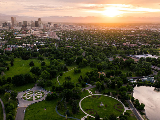
Regional photo of Denver - Aurora

The Denver - Aurora area includes the following cities: Denver, Aurora, Lakewood, Parker, Boulder, Broomfield, and Lafayette.

View Map Road List

What You Will Find On The Regional Map

The interactive metro/regional map above shows exits and toll points for each toll road that is in, or crosses into, the Denver - Aurora area.

Markers can be selected for a map of that specific exit, toll gantry or other point of interest. Exit maps will show you nearby dining, gas, EV charging, hotels and other services.

The following (2) toll roads are in this area, cross through this area or connect with this region:

Selecting a road will reveal a map of that toll road.

Advertising
Advertising

Discover Colorado Attractions

Turnpikes.com has partnered with Tiqets.com to bring you these excusive deals on attractions!

Advertising
Advertising

Regional Exits, Listed By Toll Road

A list of all exits and other points-of-interest in this region, sorted by toll road.

I-25

Exit 1AI-25 — Lone Tree

View Map & Info

▸ GPS 39.555340819 X -104.870439370
NOTES: Connects to C-470

E 470 E 470 Public Highways Authority manages this segment.

Jamaica Street

Exit 1BJamaica Street — Lone Tree

View Map & Info

▸ GPS 39.554139425 X -104.862008658
NOTES:

E 470 E 470 Public Highways Authority manages this segment.

Peoria Street

Exit 2Peoria Street — Lone Tree

View Map & Info

▸ GPS 39.552203382 X -104.839420179
NOTES:

E 470 E 470 Public Highways Authority manages this segment.

Toll Gantry A

Toll Gantry A — Denver

View Map & Info

▸ GPS 39.556322332 X -104.822200014
NOTES:

E 470 E 470 Public Highways Authority manages this segment.

Chambers Road

Exit 3Chambers Road — Parker

View Map & Info

▸ GPS 39.552941120 X -104.807997377
NOTES:

E 470 E 470 Public Highways Authority manages this segment.

Jordan Road

Exit 4Jordan Road — Parker

View Map & Info

▸ GPS 39.549008158 X -104.793409416
NOTES:

E 470 E 470 Public Highways Authority manages this segment.

Parker Road

Exit 5Parker Road — Parker

View Map & Info

▸ GPS 39.552023100 X -104.776326685
NOTES:

E 470 E 470 Public Highways Authority manages this segment.

Gartrell Road

Exit 9Gartrell Road — Aurora

View Map & Info

▸ GPS 39.577851843 X -104.723952198
NOTES:

E 470 E 470 Public Highways Authority manages this segment.

Smoky Hill Road

Exit 10Smoky Hill Road — Aurora

View Map & Info

▸ GPS 39.601182501 X -104.714183211
NOTES:

E 470 E 470 Public Highways Authority manages this segment.

E Quincy Avenue

Exit 13E Quincy Avenue — Aurora

View Map & Info

▸ GPS 39.638469905 X -104.719035204
NOTES:

E 470 E 470 Public Highways Authority manages this segment.

Toll Gantry B

Toll Gantry B — Aurora

View Map & Info

▸ GPS 39.668433859 X -104.723275019
NOTES:

E 470 E 470 Public Highways Authority manages this segment.

Jewell Avenue

Exit 16Jewell Avenue — Aurora

View Map & Info

▸ GPS 39.682016217 X -104.726329431
NOTES:

E 470 E 470 Public Highways Authority manages this segment.

6th Pkwy / Stephen D Hogan Pkwy

Exit 196th Pkwy / Stephen D Hogan Pkwy — Aurora

View Map & Info

▸ GPS 39.719345989 X -104.721042812
NOTES:

E 470 E 470 Public Highways Authority manages this segment.

I-70

Exit 20I-70 — Aurora

View Map & Info

▸ GPS 39.740231553 X -104.718784329
NOTES:

E 470 E 470 Public Highways Authority manages this segment.

Toll Gantry

Toll Gantry

View Map & Info

▸ GPS 39.757332989 X -104.716685936
NOTES: under construction

E 470 E 470 Public Highways Authority manages this segment.

Aurora Highlands Parkway

Exit 22Aurora Highlands Parkway — Aurora

View Map & Info

▸ GPS 39.769215314 X -104.716548578
NOTES:

E 470 E 470 Public Highways Authority manages this segment.

Toll Gantry C

Toll Gantry C — Aurora

View Map & Info

▸ GPS 39.770799451 X -104.716512050
NOTES:

E 470 E 470 Public Highways Authority manages this segment.

48th Avenue

48th Avenue

View Map & Info

▸ GPS 39.783746853 X -104.716374946
NOTES: under construction

E 470 E 470 Public Highways Authority manages this segment.

56th Avenue

Exit 2456th Avenue — Aurora

View Map & Info

▸ GPS 39.798276947 X -104.716231559
NOTES:

E 470 E 470 Public Highways Authority manages this segment.

64th Avenue

Exit 2564th Avenue — Aurora

View Map & Info

▸ GPS 39.812738510 X -104.720805029
NOTES:

E 470 E 470 Public Highways Authority manages this segment.

Peña Bouelvard

Exit 28/28A/28BPeña Bouelvard — Aurora

View Map & Info

▸ GPS 39.834483346 X -104.747001547
NOTES:

E 470 E 470 Public Highways Authority manages this segment.

Toll Gantry D

Toll Gantry D — Commerce City

View Map & Info

▸ GPS 39.861204217 X -104.750030201
NOTES:

E 470 E 470 Public Highways Authority manages this segment.

96th Avenue

Exit 3196th Avenue — Commerce City

View Map & Info

▸ GPS 39.870664210 X -104.755657473
NOTES:

E 470 E 470 Public Highways Authority manages this segment.

104th Avenue

Exit 32104th Avenue — Commerce City

View Map & Info

▸ GPS 39.885528488 X -104.761942195
NOTES:

E 470 E 470 Public Highways Authority manages this segment.

120th Avenue

Exit 34120th Avenue — Commerce City

View Map & Info

▸ GPS 39.914339750 X -104.782117275
NOTES:

E 470 E 470 Public Highways Authority manages this segment.

I-76

Exit 35I-76 — Brighton

View Map & Info

▸ GPS 39.924863230 X -104.803655470
NOTES:

E 470 E 470 Public Highways Authority manages this segment.

US Hwy 85

Exit 38US Hwy 85 — Brighton

View Map & Info

▸ GPS 39.934095930 X -104.845849213
NOTES:

E 470 E 470 Public Highways Authority manages this segment.

Toll Gantry E

Toll Gantry E — Brighton

View Map & Info

▸ GPS 39.953570774 X -104.874181386
NOTES:

E 470 E 470 Public Highways Authority manages this segment.

Quebec Street

Exit 41Quebec Street — Denver

View Map & Info

▸ GPS 39.961205356 X -104.903366322
NOTES:

E 470 E 470 Public Highways Authority manages this segment.

Colorado Boulevard

Exit 43Colorado Boulevard — Thornton

View Map & Info

▸ GPS 39.974408682 X -104.936918525
NOTES:

E 470 E 470 Public Highways Authority manages this segment.

York Street

Exit 45York Street — Thornton

View Map & Info

▸ GPS 39.976083088 X -104.959547761
NOTES:

E 470 E 470 Public Highways Authority manages this segment.

I-25

Exit 47I-25 — Thornton

View Map & Info

▸ GPS 39.981656615 X -104.988159354
NOTES: Connects to Northwest Parkway

E 470 E 470 Public Highways Authority manages this segment.

I-25

Exit 47I-25 — Broomfield

View Map & Info

▸ GPS 39.981656615 X -104.988159354
NOTES: Connects to E-470

Northwest Parkway Northwest Parkway Public Highway Authority manages this segment.

Sheridan Parkway

Exit 48Sheridan Parkway — Broomfield

View Map & Info

▸ GPS 39.984131959 X -105.018543630
NOTES:

Northwest Parkway Northwest Parkway Public Highway Authority manages this segment.

Toll Gantry

Toll Gantry

View Map & Info

▸ GPS 39.980200559 X -105.041029180
NOTES:

Northwest Parkway Northwest Parkway Public Highway Authority manages this segment.

US Hwy 287

Exit 52US Hwy 287 — Broomfield

View Map & Info

▸ GPS 39.958611924 X -105.090265770
NOTES:

Northwest Parkway Northwest Parkway Public Highway Authority manages this segment.

S 96th Street / Via Varra

S 96th Street / Via Varra — Broomfield

View Map & Info

▸ GPS 39.949012757 X -105.125484170
NOTES:

Northwest Parkway Northwest Parkway Public Highway Authority manages this segment.

Via Varra / Tape Dr

Via Varra / Tape Dr

View Map & Info

▸ GPS 39.940804373 X -105.127781879
NOTES:

Northwest Parkway Northwest Parkway Public Highway Authority manages this segment.

US Hwy 36

US Hwy 36 — Broomfield

View Map & Info

▸ GPS 39.934839038 X -105.127321563
NOTES: Connects to Interlocken Loop

Northwest Parkway Northwest Parkway Public Highway Authority manages this segment.

Advertising
Advertising
Regional photo of Denver - Aurora

Visiting In The Denver - Aurora Area?

We have partnered with Hotels.com to help you get the best deal on hotels.

Find Hotels

Things to do around Denver - Aurora

Things To Do While You're Here

We have partnered with Tiqets to bring you deals on dining and attractions.

EXPLORE COLORADO

Journey to key destinations around and adjacent to Colorado!

Map Of This Region ▹

Communities in this metro area include Denver, Aurora, Lakewood, Parker, Boulder, Broomfield, and Lafayette.

Individual toll maps for this region are listed below.

Turnpikes.com is proud to partner with the following: