E-470 At Toll Gantry C

Advertising
Advertising

Your selected location relative to roadway

See below for more about this area

Advertising
Advertising

About This Location

Toll Gantry C

At A Glance

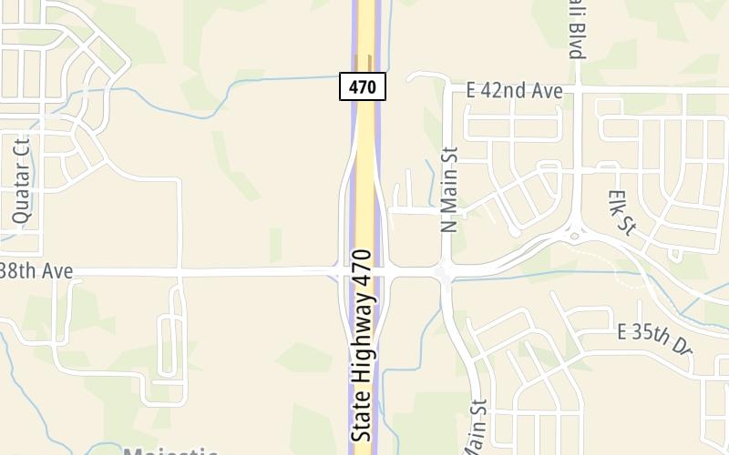
This toll point is located in Aurora. Denver is nearby.

This location is in the Denver - Aurora area.

Interactive Map Above

This location's approximate GPS Coordinates are 39.77080 x -104.71651.

On to 48th Avenue, about 0.9 miles away ►

◄ Back to Aurora Highlands Parkway, about 0.1 miles away.

View Map Travel Conditions

Above: Map image © TomTom Intl BV

Using The POI Map

The interactive map will help you orient this location in relationship to other junctions.

Current driving conditions and weather may also be found below the map.

View Map Weather

Static map of E 470 at Toll Gantry C
Static map. Interactive map is above.
Advertising
Advertising

Travel Conditions At Toll Gantry C

Current Weather And Visibility

  • 16 7 04
  • Mostly Sunny

    68°F / 20°C

    Feels Like:

    75°F / 23.7°C

  • Visibility

    1 Mi / 2 Km

    3-Hour Precip:

    0 In / 0.0 Cm

  • South Southwest
    Winds (SSW)

    4.3 MPH / 6.9 KPH

    Gusts:

    11.7 MPH / 18.8 KPH

▸ Get the full forecast for the Denver - Aurora area

Available Cameras

No camera feed …

There is no currently-available traffic camera feed for this location.

Advertising
Advertising

Travel Pictures

No photos …

There are no currently-available photos for this location.

Advertising
Advertising

EXPLORE COLORADO

Journey to key destinations around and adjacent to Colorado!

Map Of This Region ▹

Communities in this metro area include Denver, Aurora, Lakewood, Parker, Boulder, Broomfield, and Lafayette.

Individual toll maps for this region are listed below.

Advertising
Advertising
Turnpikes.com is proud to partner with the following: